MyTopo
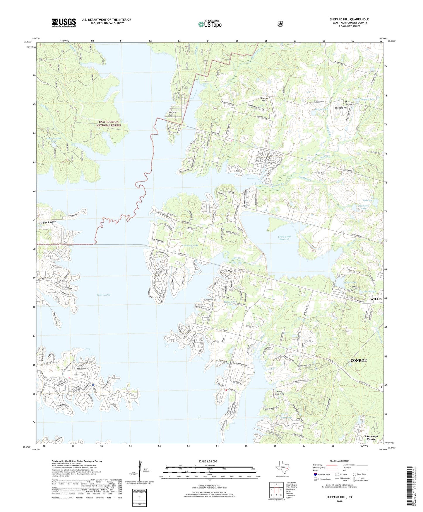
Shepard Hill Texas US Topo Map
Couldn't load pickup availability
Also explore the Shepard Hill Forest Service Topo of this same quad for updated USFS data
2022 topographic map quadrangle Shepard Hill in the state of Texas. Scale: 1:24000. Based on the newly updated USGS 7.5' US Topo map series, this map is in the following counties: Montgomery. The map contains contour data, water features, and other items you are used to seeing on USGS maps, but also has updated roads and other features. This is the next generation of topographic maps. Printed on high-quality waterproof paper with UV fade-resistant inks.
Quads adjacent to this one:
West: Montgomery
Northwest: San Jacinto
North: Moore Grove
Northeast: New Waverly
East: Willis
Southeast: Conroe
South: Cowl Spur
Southwest: Keenan
This map covers the same area as the classic USGS quad with code o30095d5.
Contains the following named places: Atkins Creek, Bell Creek, Calfee Lake, Camp Letcher Pond, Camp Robinwood, Chambers Creek, Chambers Lake, Chambers Lake Dam, Flying Hare Field, Gdap Air Ranch, Glenview Number 1 Heliport, Gum Branch, Hostetter Creek, Hulon Lake, Hulon Lake Dam, Johnson Bluff, Kleimann Lake, Lake Ann, Lake Ann Dam, Lake Conroe, Lake Paula, Lake Wesley, Lewis Creek, Lewis Creek Dam, Lewis Creek Reservoir, Live Branch, Montgomery County Sheriff's Office - District 5 Patrol, Montgomery Fire Department Station 54, North Montgomery County Fire Department Station 94, North Montgomery County Fire Department Station 96, Peach Creek, Phelps Lake, Pin Oak Ravine, Protec Ambulance Transport, Sand Branch, Sartor Heliport, Shepard Branch, Shepard Cemetery, Shepard Hill, Shepard Lake, South Branch, Weirs Creek, Williamson Lake, Willis Oil Field, ZIP Code: 77318