MyTopo
Keenan Texas US Topo Map
Couldn't load pickup availability
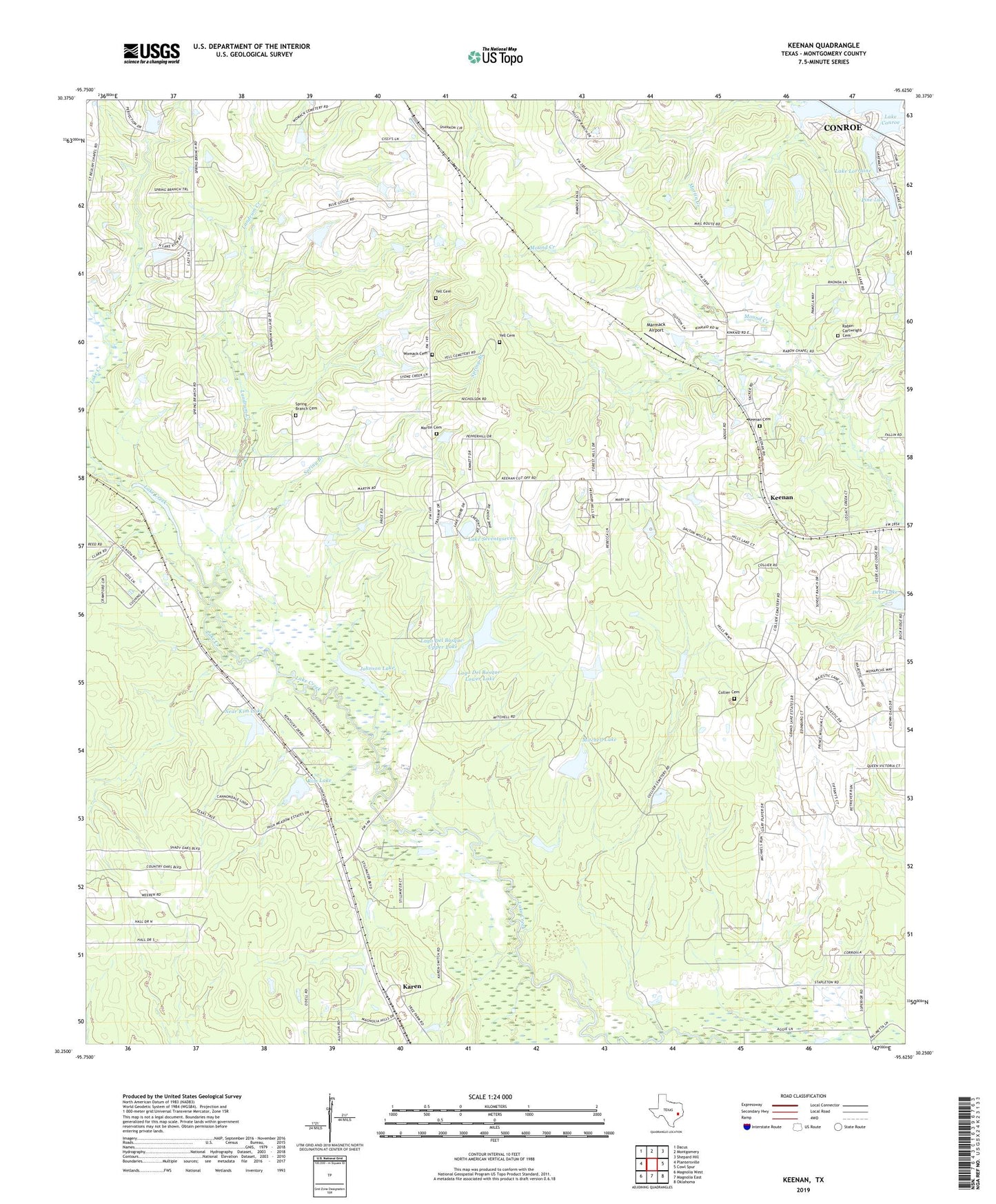
2022 topographic map quadrangle Keenan in the state of Texas. Scale: 1:24000. Based on the newly updated USGS 7.5' US Topo map series, this map is in the following counties: Montgomery. The map contains contour data, water features, and other items you are used to seeing on USGS maps, but also has updated roads and other features. This is the next generation of topographic maps. Printed on high-quality waterproof paper with UV fade-resistant inks.
Quads adjacent to this one:
West: Plantersville
Northwest: Dacus
North: Montgomery
Northeast: Shepard Hill
East: Cowl Spur
Southeast: Oklahoma
South: Magnolia East
Southwest: Magnolia West
This map covers the same area as the classic USGS quad with code o30095c6.
Contains the following named places: Collier Cemetery, Deer Lake, Deer Lake Dam, Gary, Johnson Lake, Karen, Keenan, Keenan Cemetery, Kim Lake, Kim Lake Dam, Lago del Bosque, Lago Del Bosque-Lower Lake, Lago Del Bosque-Lower Lake Dam, Lago Del Bosque-Upper Lake, Lago Del Bosque-Upper Lake Dam, Lake Lorraine, Lake Lorraine Dam, Lake Seventyseven, Landrum Creek, Marmack Airport, Martin Cemetery, Mitchell Lake, Mitchell Lake Dam, Montgomery County Hospital District Emergency Medical Services Station 47, Montgomery Fire Department Station 52, Montgomery Siding, Near Kim Lake, Near Kim Lake Dam, Old Lake 177, Old Lake 177 Dam, Pine Lake, Pine Lake Dam, Rabon Cartwright Cemetery, Rabon Chapel, Saint Beulah Church, Spring Branch, Spring Branch Cemetery, Spring Tabernacle, Tri Lake Number 1, Tri Lake Number 1 Dam, Womack Cemetery, Yell Cemetery, ZIP Code: 77316