MyTopo
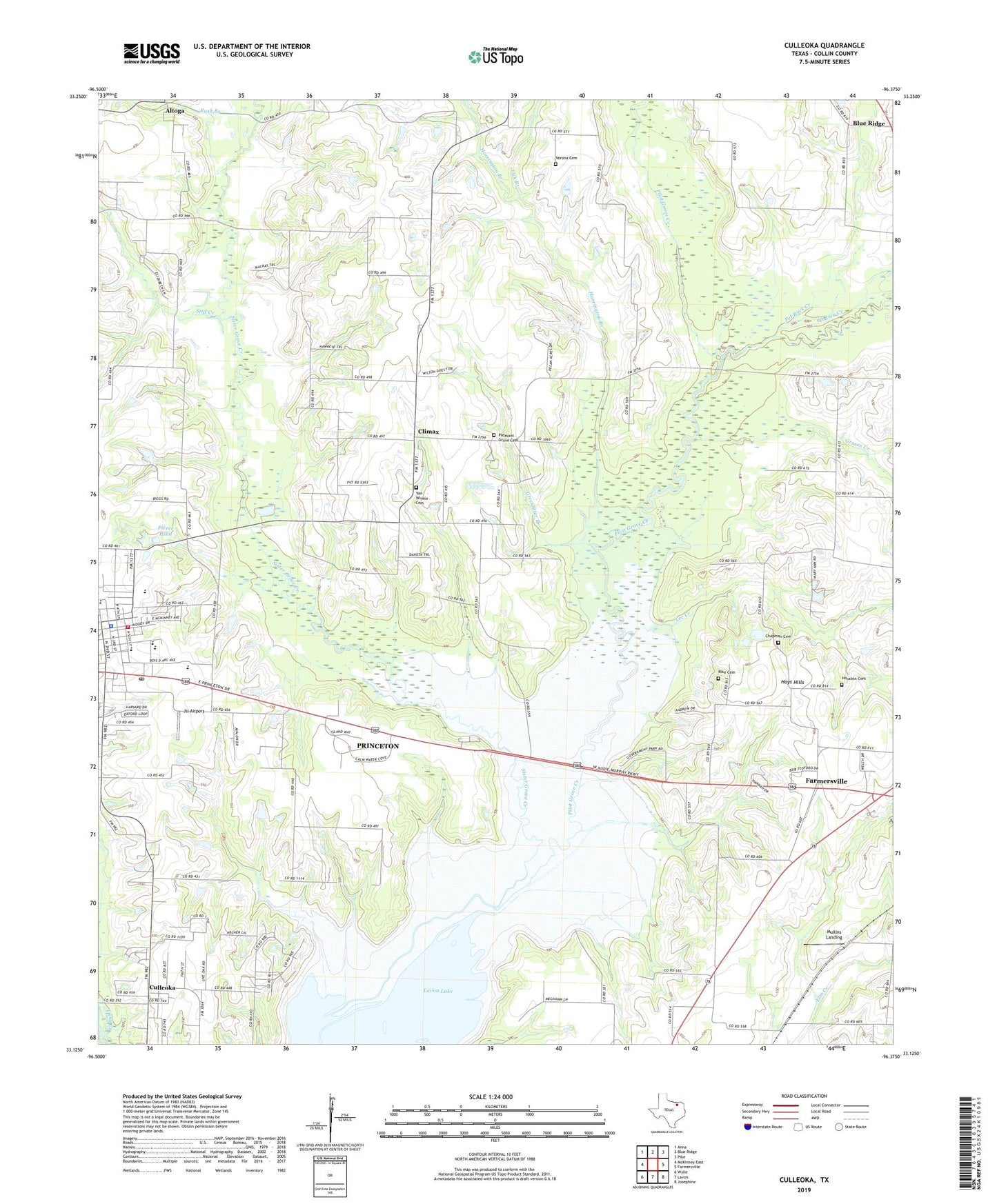
Culleoka Texas US Topo Map
Couldn't load pickup availability
2019 topographic map quadrangle Culleoka in the state of Texas. Scale: 1:24000. Based on the newly updated USGS 7.5' US Topo map series, this map is in the following counties: Collin. The map contains contour data, water features, and other items you are used to seeing on USGS maps, but also has updated roads and other features. This is the next generation of topographic maps. Printed on high-quality waterproof paper with UV fade-resistant inks.
Quads adjacent to this one:
West: McKinney East
Northwest: Anna
North: Blue Ridge
Northeast: Pike
East: Farmersville
Southeast: Josephine
South: Lavon
Southwest: Wylie
Contains the following named places: Altoga, Blue Ridge Park, Caddo Park, Chapman Cemetery, City of Princeton, Clark Middle School, Climax, Culleoka, Delta-B Ranch Heliport, Elm Creek Park, Farmersville Division, Greenbrier Branch, Groves Creek, Harrington Branch, Hays Hills, Henslee Chapel, Housten Cemetery, Indian Creek, Jsi Airport, Lee Creek, Lewis Lake, Lewis Lake Dam, Lick Branch, Mullins Landing, Panther Stadium, Pecks Heliport, Pierce Pond, Pierce Pond Dam, Pilot Grove Creek, Pleasant Grove Cemetery, Pot Rack Creek, Princeton, Princeton Elementary School, Princeton Fire Department, Princeton High School, Princeton Police Department, Princeton Post Office, Rike Cemetery, Rush Branch, Sister Grove Creek, Sister Grove Park Trail, Stiff Creek, Texas No Name Number 26 Dam, Twin Groves Park, Van Winkle Cemetery, Verona Cemetery, Verona Church, ZIP Code: 75407