MyTopo
Lavon Texas US Topo Map
Couldn't load pickup availability
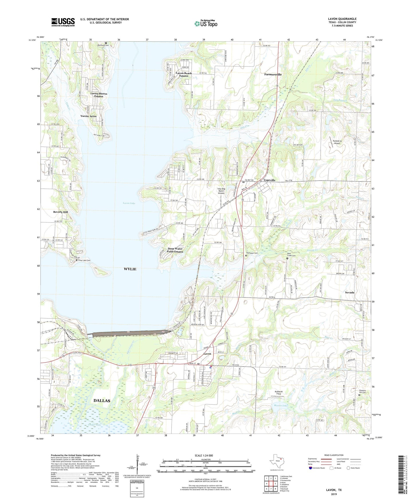
2022 topographic map quadrangle Lavon in the state of Texas. Scale: 1:24000. Based on the newly updated USGS 7.5' US Topo map series, this map is in the following counties: Collin. The map contains contour data, water features, and other items you are used to seeing on USGS maps, but also has updated roads and other features. This is the next generation of topographic maps. Printed on high-quality waterproof paper with UV fade-resistant inks.
Quads adjacent to this one:
West: Wylie
Northwest: McKinney East
North: Culleoka
Northeast: Farmersville
East: Josephine
Southeast: Royse City
South: Rockwall
Southwest: Rowlett
This map covers the same area as the classic USGS quad with code o33096a4.
Contains the following named places: Avalon Park, Backbone Cemetery, Bear Creek Cemetery, Bell Lake, Bell Lake Dam, Beverly Hill, Boyd Lake, Boyd Lake Dam, City of Lavon, Clear Lake, Clear Lake Cemetery, Clear Lake Park, Copeville, Copeville Post Office, Cottonwood Park, Culleoka Park, Deep Water Point Estates, Elm Creek, George Creek, Kudlacek Field, Lakeland Park, Lavon, Lavon Beach Estates, Lavon City Hall, Lavon Dam, Lavon Lake, Lavon Police Department, Lavon Post Office, Lavon Shores Estates, Lavon Volunteer Fire Department, Lavonia Park, Lazy Dog Ranch Airpark, Little Ridge, Little Ridge Park, Mallard Park, Moores Lake, Nevada Division, Nevada Volunteer Fire Department, New Mesquite, Pebble Beach Park, Pebble Beach Sunset Acres, Pleasant Hill Cemetery, Price Creek, Soil Conservation Service Site 2 Dam, Thompson Cemetery, Ticky Creek, Ticky Creek Park, Tom Bean Creek, Twisted JS Airport, Wilson Lake, Yucote Acres, ZIP Codes: 75166, 75173