MyTopo
Dallardsville Texas US Topo Map
Couldn't load pickup availability
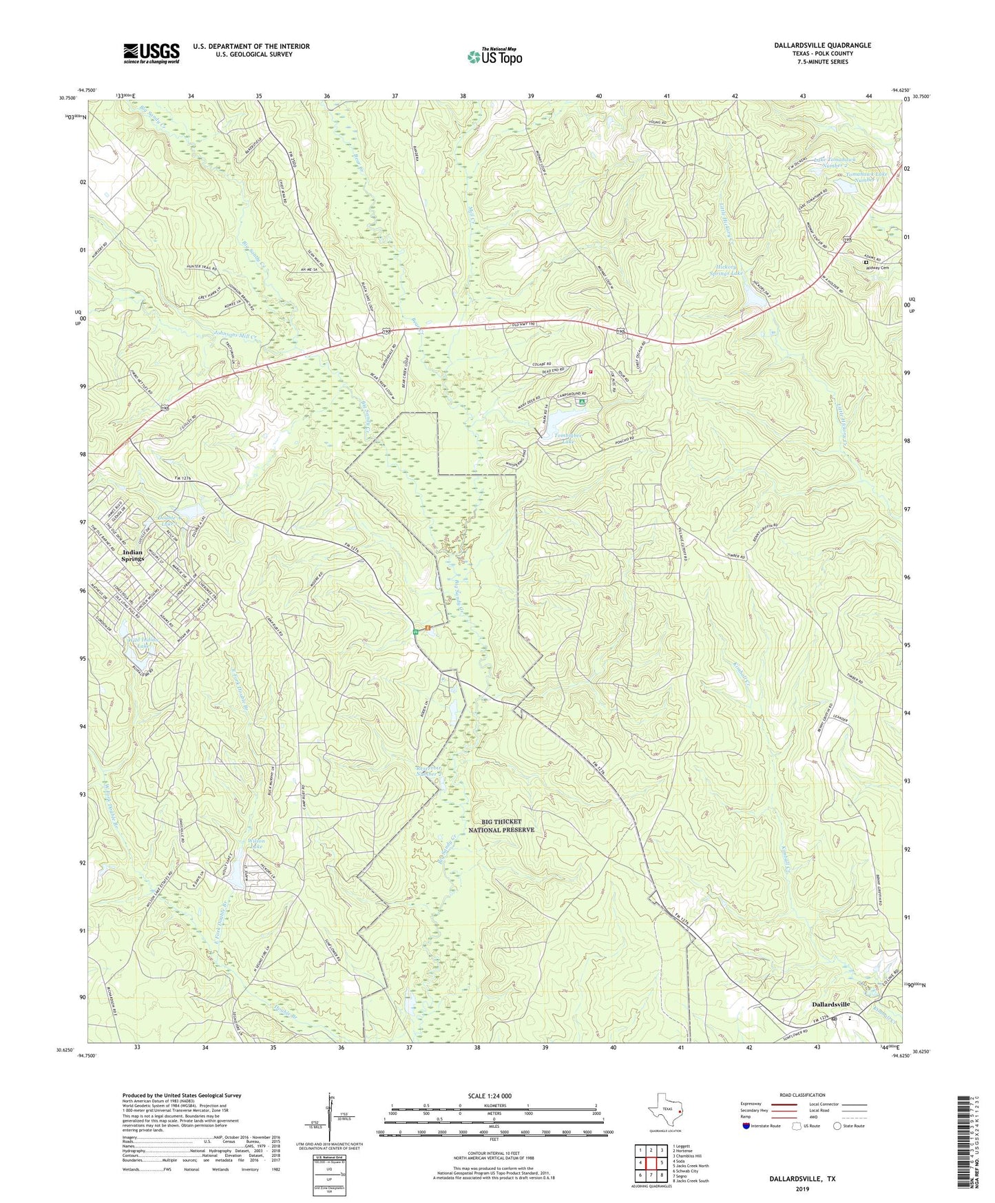
2019 topographic map quadrangle Dallardsville in the state of Texas. Scale: 1:24000. Based on the newly updated USGS 7.5' US Topo map series, this map is in the following counties: Polk. The map contains contour data, water features, and other items you are used to seeing on USGS maps, but also has updated roads and other features. This is the next generation of topographic maps. Printed on high-quality waterproof paper with UV fade-resistant inks.
Quads adjacent to this one:
West: Soda
Northwest: Leggett
North: Hortense
Northeast: Chambliss Hill
East: Jacks Creek North
Southeast: Jacks Creek South
South: Segno
Southwest: Schwab City
Contains the following named places: Alabama - Coushatta Indian Nation Fire Department, Alabama-Coushatta Reservation, Bear Creek, Big Thicket - Woodlands Trail, Camp Ruby, Dallardsville, Dallardsville Post Office, Double A Lake 1, Double A Lake 1 Dam, Double A Lakes, East Fork Double Branch, Hickory Springs Dam, Hickory Springs Lake, Indian Springs Census Designated Place, Indian Village, Johnsons Mill Creek, Lake Downs, Lake Downs Dam, Lake Mark, Lake Mark Dam, Lake Tomahawk Number 2, Lake Tomahawk Number 2 Dam, Lovell Reservoir Number 2 Levee, Midway Cemetery, Midway Church, Mill Creek, New Camp Ruby, Pond 2 Dam, Reservoir Number 2, Sunflower Church, Tomahawk Lake Number 1, Tomahawk Lake Number 1 Dam, Tombigbee Dam, Tombigbee Lake, West Fork Double Branch, Wild Indian Lake, Wild Indian Lake Dam, Wilson Lake, Wilson Lake Dam