MyTopo
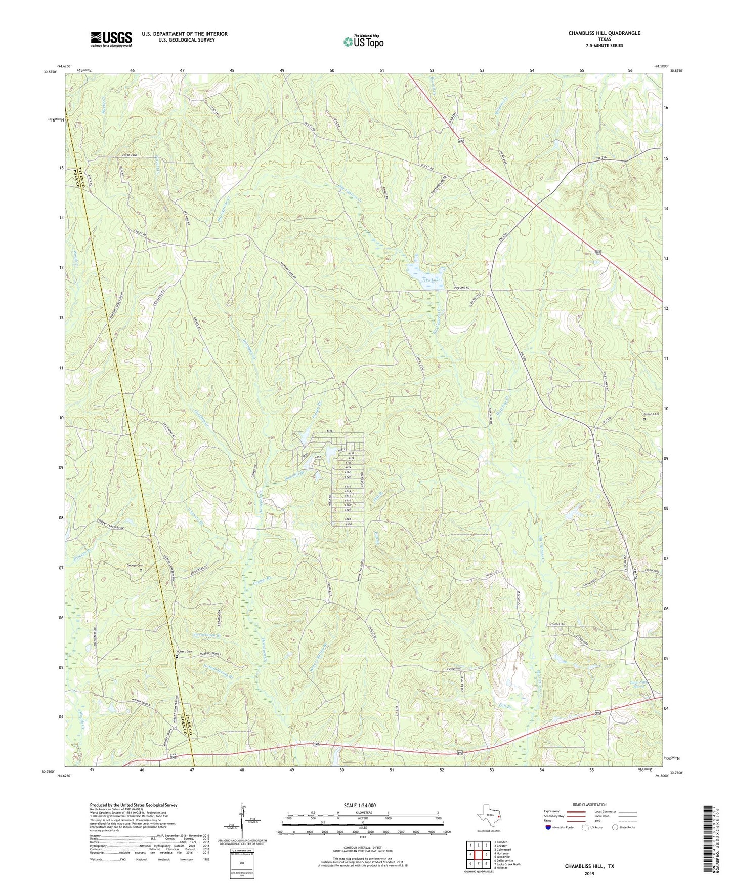
Chambliss Hill Texas US Topo Map
Couldn't load pickup availability
2022 topographic map quadrangle Chambliss Hill in the state of Texas. Scale: 1:24000. Based on the newly updated USGS 7.5' US Topo map series, this map is in the following counties: Tyler, Polk. The map contains contour data, water features, and other items you are used to seeing on USGS maps, but also has updated roads and other features. This is the next generation of topographic maps. Printed on high-quality waterproof paper with UV fade-resistant inks.
Quads adjacent to this one:
West: Hortense
Northwest: Camden
North: Chester
Northeast: Colmesneil
East: Woodville
Southeast: Hillister
South: Jacks Creek North
Southwest: Dallardsville
This map covers the same area as the classic USGS quad with code o30094g5.
Contains the following named places: Camp Niwa Spring, Camp Niwana, Conner Branch, Coontop Creek, Fall Branch, Flat Branch, George Cemetery, Hubert Cemetery, Hubert Spring Branch, Jeko Lake, Jeko Lake Dam, New Shiloh Church, Pigpen Branch, Sawmill Branch, Shady Grove Church, Shiloh Cemetery, Shiloh Church, Swearingen Branch, Treasure Branch, Waters Spring Branch, Wolf Pen Creek