MyTopo
Daniels Chapel Texas US Topo Map
Couldn't load pickup availability
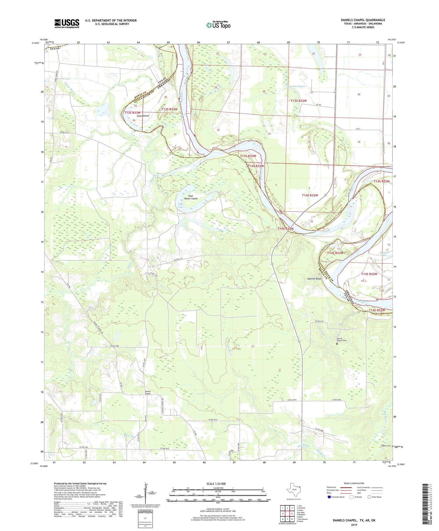
2019 topographic map quadrangle Daniels Chapel in the states of Texas, Arkansas. Scale: 1:24000. Based on the newly updated USGS 7.5' US Topo map series, this map is in the following counties: Bowie, Little River, McCurtain. The map contains contour data, water features, and other items you are used to seeing on USGS maps, but also has updated roads and other features. This is the next generation of topographic maps. Printed on high-quality waterproof paper with UV fade-resistant inks.
Quads adjacent to this one:
West: De Kalb
Northwest: Tom
North: Foreman
Northeast: Arden
East: Redbank
Southeast: Hooks
South: New Boston
Southwest: Malta
Contains the following named places: Almont School, Brushy Lake, Choctaw Bayou, Daniels Chapel, Daniels Creek, Gano Island, Holly Creek, Hooks Bayou, Hughes Cemetery, Hurricane Bend Lake, Macedonia Church, Moser Ranch Airfield, Mud Creek, New Lake, New Zion Church, Paul Moore Island, Pleasant Hill Church, Royal Chapel, Royal Chapel School, Spanish Bluff, Spring Branch, Spring Branch Cemetery, Township of Richland, Woodstock