MyTopo
Redbank Texas US Topo Map
Couldn't load pickup availability
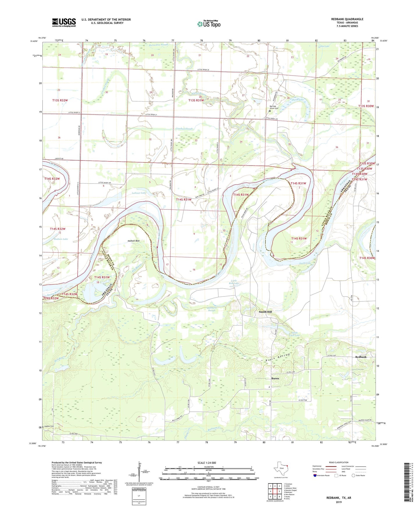
2022 topographic map quadrangle Redbank in the states of Arkansas, Texas. Scale: 1:24000. Based on the newly updated USGS 7.5' US Topo map series, this map is in the following counties: Bowie, Little River. The map contains contour data, water features, and other items you are used to seeing on USGS maps, but also has updated roads and other features. This is the next generation of topographic maps. Printed on high-quality waterproof paper with UV fade-resistant inks.
Quads adjacent to this one:
West: Daniels Chapel
Northwest: Foreman
North: Arden
Northeast: Ashdown West
East: Barkman
Southeast: Leary
South: Hooks
Southwest: New Boston
This map covers the same area as the classic USGS quad with code o33094e3.
Contains the following named places: Applewhite Cut-off Lake, Black Bottom, Burns, Cattail Lake, Cedar Springs Church, Cranfell Lake, Cranfill Airfield, Crooked Slough, Dunn Lake, Ector Lake, Elizabeth Baptist Church, Friendship Church, Friendship School, Hubbard Slough, Hudson Bow, Hudson Lake, Jack Creek, LaVoice Lake, Little Red Lake, Panther Creek, Red Bayou, Red Oak Baptist Church, Red Oak Grove Cemetery, Redbank, Smith Club Dam, Smith Club Lake, Smith Hill, Smith Lake, Walnut Grove Church, Whaley Lake, Wilson Lake, ZIP Code: 75561