MyTopo
Darco Texas US Topo Map
Couldn't load pickup availability
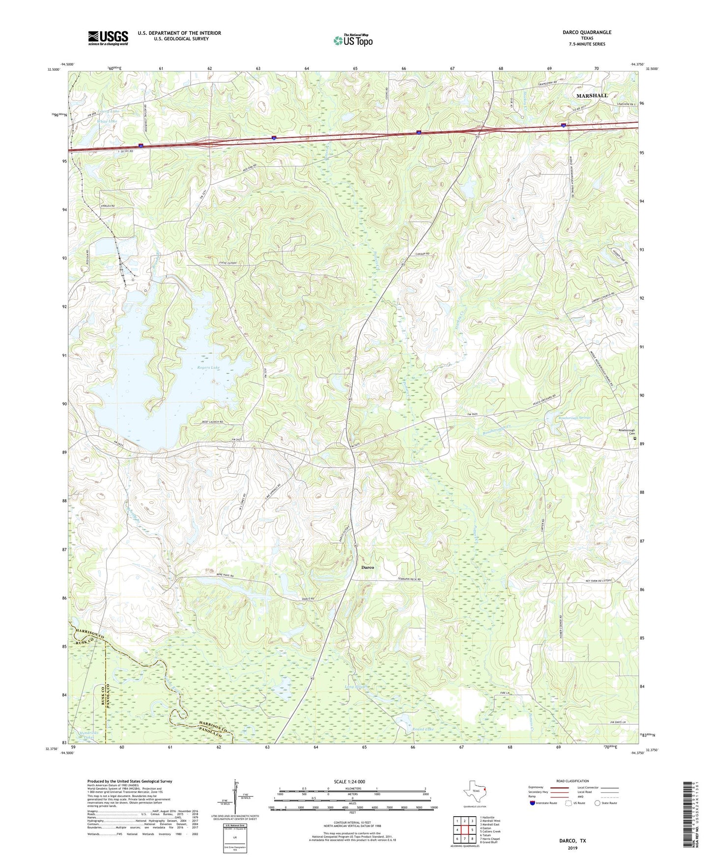
2019 topographic map quadrangle Darco in the state of Texas. Scale: 1:24000. Based on the newly updated USGS 7.5' US Topo map series, this map is in the following counties: Harrison, Panola, Rusk. The map contains contour data, water features, and other items you are used to seeing on USGS maps, but also has updated roads and other features. This is the next generation of topographic maps. Printed on high-quality waterproof paper with UV fade-resistant inks.
Quads adjacent to this one:
West: Easton
Northwest: Hallsville
North: Marshall West
Northeast: Marshall East
East: Colliers Creek
Southeast: Grand Bluff
South: Harris Chapel
Southwest: Tatum
Contains the following named places: Atlas Church, Brandy Branch, Canaan School, Cave Springs Church, Darco, Darco Mine, East Potters Creek, Grange Hall Church, Harrison County Emergency Services District 4 Station 2, Hatley Creek, Hendricks Lakes, Long Slough, Lowry Lake, Lowry Lake Dam, New Point Church, Red Oaks Church, Rogers Lake, Roseborough Cemetery, Roseborough Creek, Roseborough Springs, Round Lake, Saint Mary Church, Starkey Creek, White Lake, White Lake Dam