MyTopo
Darst Creek Texas US Topo Map
Couldn't load pickup availability
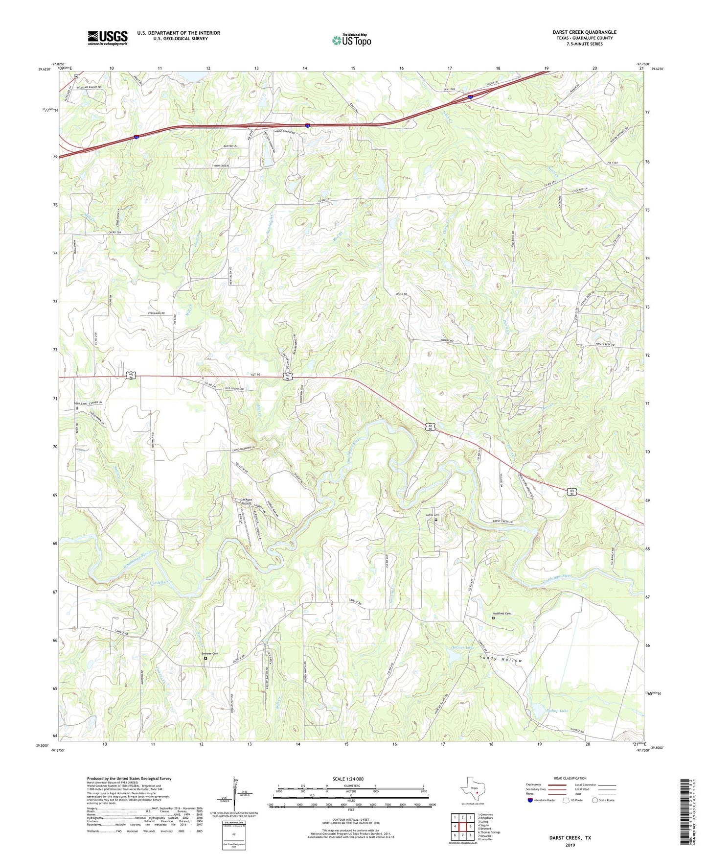
2019 topographic map quadrangle Darst Creek in the state of Texas. Scale: 1:24000. Based on the newly updated USGS 7.5' US Topo map series, this map is in the following counties: Guadalupe. The map contains contour data, water features, and other items you are used to seeing on USGS maps, but also has updated roads and other features. This is the next generation of topographic maps. Printed on high-quality waterproof paper with UV fade-resistant inks.
Quads adjacent to this one:
West: Seguin
Northwest: Geronimo
North: Kingsbury
Northeast: Luling
East: Belmont
Southeast: Leesville
South: Dewville
Southwest: Thomas Springs
Contains the following named places: Bishop Lake, Bishop Lake Dam, Brenner Cemetery, Capote Church, City of Kingsbury, Cordell Creek, Darst Creek, Darst Oil Field, Deer Creek, Eden Cemetery, Glen Beicker Ranch Airport, Holmes Lake, Holmes Lake Dam, Jahns Cemetery, Lackorn Airport, Long Branch, Matthies Cemetery, Mill Creek, New Salem Baptist Church, New Salem Church, Polecat Creek, Randolph Creek, Red Branch, Rocky Creek, Salt Creek, Sandy Hollow, Saul Creek, Sawlog Creek, Seguin East Division