MyTopo
Geronimo Texas US Topo Map
Couldn't load pickup availability
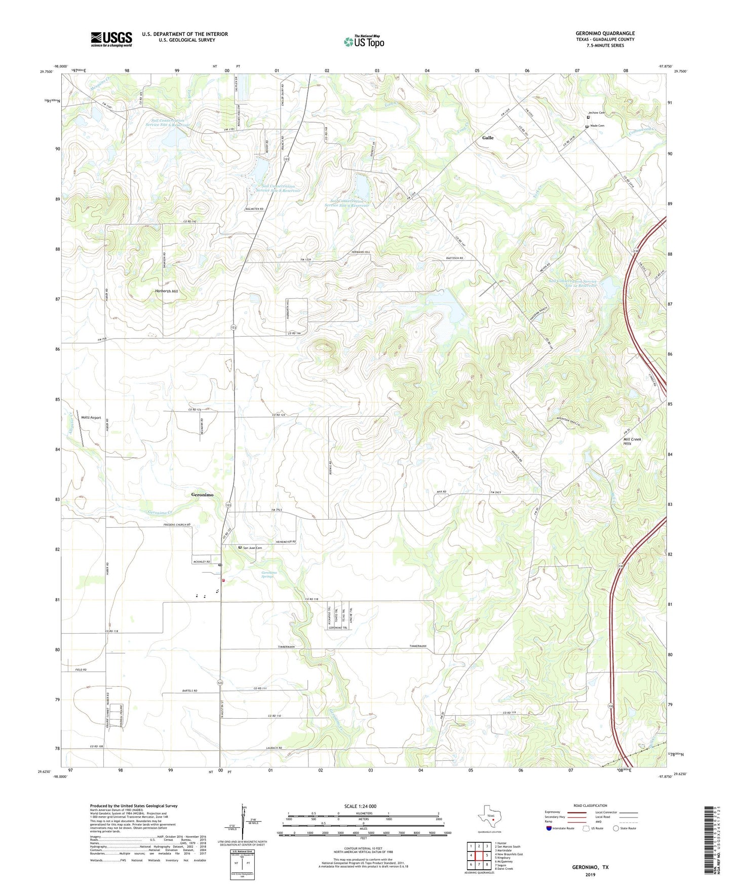
2022 topographic map quadrangle Geronimo in the state of Texas. Scale: 1:24000. Based on the newly updated USGS 7.5' US Topo map series, this map is in the following counties: Guadalupe. The map contains contour data, water features, and other items you are used to seeing on USGS maps, but also has updated roads and other features. This is the next generation of topographic maps. Printed on high-quality waterproof paper with UV fade-resistant inks.
Quads adjacent to this one:
West: New Braunfels East
Northwest: Hunter
North: San Marcos South
Northeast: Martindale
East: Kingsbury
Southeast: Darst Creek
South: Seguin
Southwest: McQueeney
This map covers the same area as the classic USGS quad with code o29097f8.
Contains the following named places: Alligator Creek, Copperas Cove Public Library, Galle, Geronimo, Geronimo Census Designated Place, Geronimo Post Office, Geronimo Springs, Geronimo Volunteer Fire Department, Good Shepard Evangelical Church, Harborth Hill, Jechow Cemetery, Lauback, Long Creek, Mesquite Creek, Moltz Airport, Navarro Elementary School, Navarro High School, Navarro Middle School, Navarro School, San Juan Cemetery, Seguin North Division, Silva Park, Soil Conservation Service Site 11 Dam, Soil Conservation Service Site 11 Reservoir, Soil Conservation Service Site 12 Dam, Soil Conservation Service Site 12 Reservoir, Soil Conservation Service Site 6 Dam, Soil Conservation Service Site 6 Reservoir, Soil Conservation Service Site 8 Dam, Soil Conservation Service Site 8 Reservoir, Soil Conservation Service Site 9 Dam, Soil Conservation Service Site 9 Reservoir, Texas No Name Number 46 Dam, Wade Cemetery