MyTopo
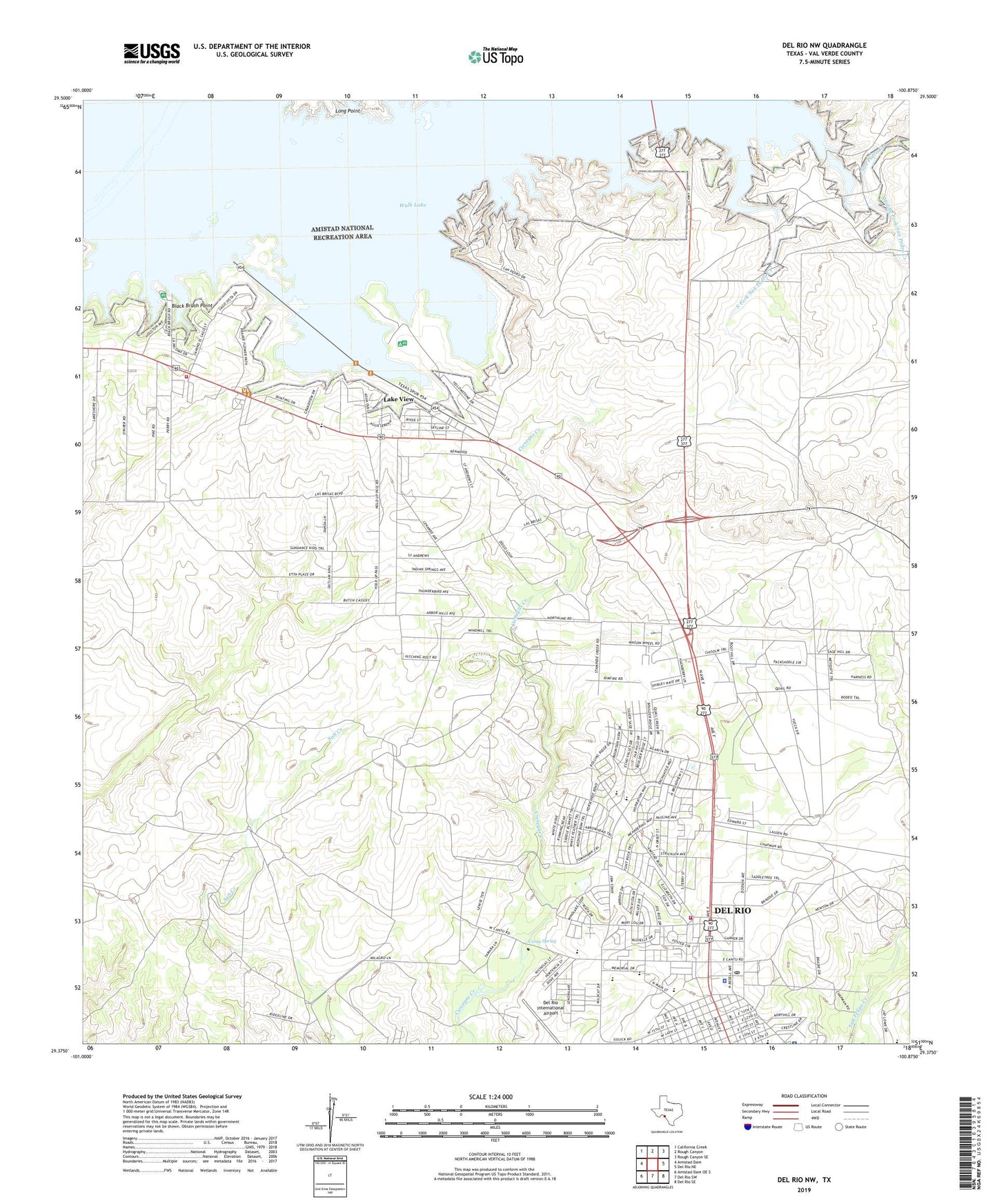
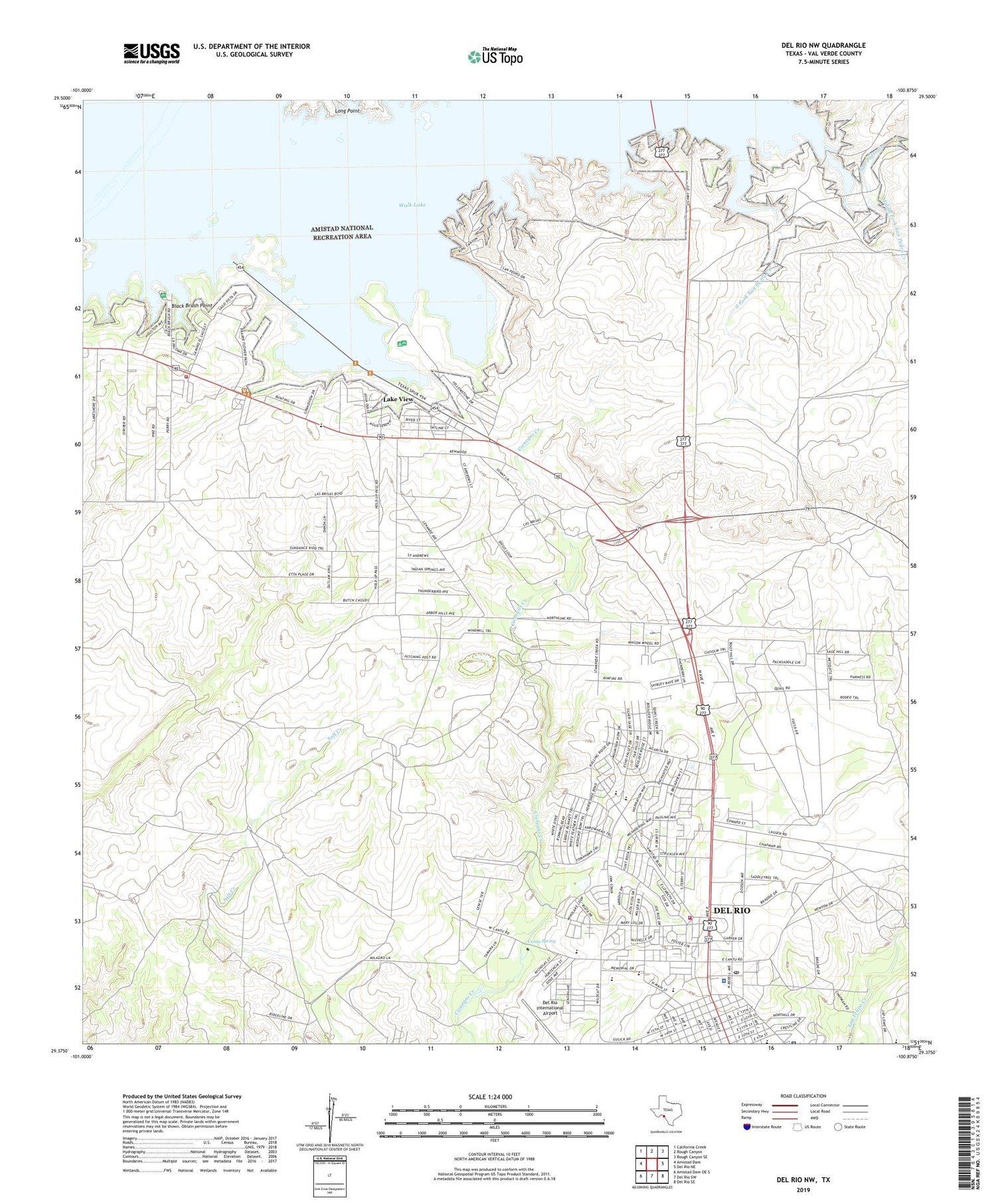
Del Rio NW Texas US Topo Map
Couldn't load pickup availability
2019 topographic map quadrangle Del Rio NW in the state of Texas. Scale: 1:24000. Based on the newly updated USGS 7.5' US Topo map series, this map is in the following counties: Val Verde. The map contains contour data, water features, and other items you are used to seeing on USGS maps, but also has updated roads and other features. This is the next generation of topographic maps. Printed on high-quality waterproof paper with UV fade-resistant inks.
Quads adjacent to this one:
West: Amistad Dam
Northwest: California Creek
North: Rough Canyon
Northeast: Rough Canyon SE
East: Del Rio NE
Southeast: Del Rio SE
South: Del Rio SW
Southwest: Amistad Dam OE S
Contains the following named places: Black Brush Point, Buena Vista Elementary School, Buena Vista Park, Cantu Spring, Christ Bible Fellowship Church, Del Rio Fire and Rescue Station 2, Del Rio Fire Department Fire Marshal's Office, Del Rio High School, Del Rio Middle School, Del Rio Ninth Grade Center, Del Rio Police Department, Del Rio Post Office, Grace Lutheran Church, Irene C Cardwell Elementary School, KDLK-FM (Del Rio), KLKE-AM (Del Rio), Korean Presbyterian Church, Lake View, Lake View Addition Colonia, Lake View Census Designated Place, Los Campos Number 1 2 and 5 Colonia, Los Campos Number 3 and 4 Colonia, Memorial Middle School, Middle Fork San Pedro Creek, North Heights Elementary School, Northside Baptist Church, San Felipe Del Rio Consolidated Independent School District Security / Police Department, San Pedro Canyon, San Pedro Creek, South Fork San Pedro Creek, United States Border Patrol Del Rio Sector Headquarters, Val Verde County Rural Volunteer Fire Department Station 4, Val Verde Regional Medical Center