MyTopo
Amistad Dam Texas US Topo Map
Couldn't load pickup availability
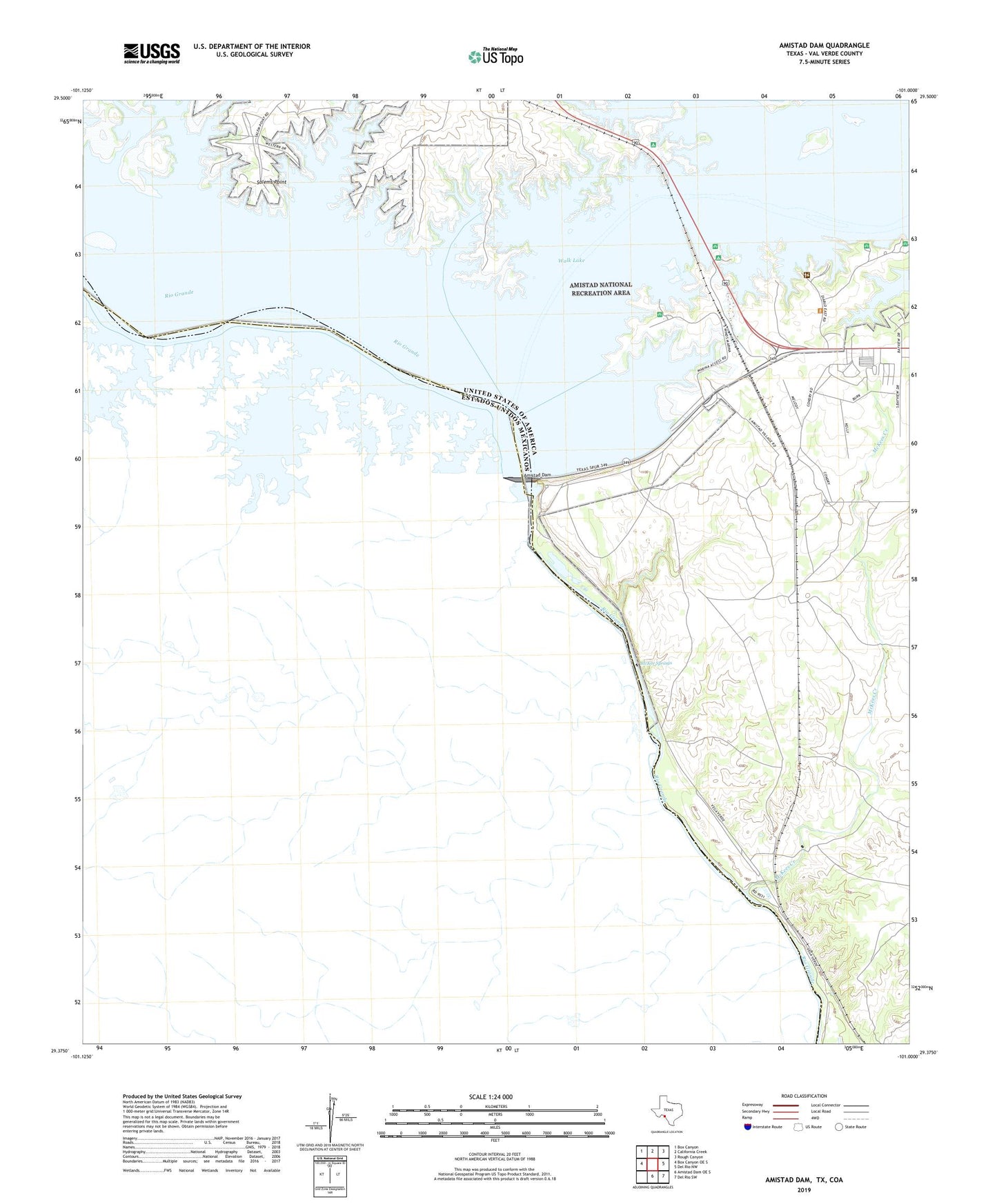
2022 topographic map quadrangle Amistad Dam in the state of Texas. Scale: 1:24000. Based on the newly updated USGS 7.5' US Topo map series, this map is in the following counties: Val Verde. The map contains contour data, water features, and other items you are used to seeing on USGS maps, but also has updated roads and other features. This is the next generation of topographic maps. Printed on high-quality waterproof paper with UV fade-resistant inks.
Quads adjacent to this one:
West: Box Canyon OE S
Northwest: Box Canyon
North: California Creek
Northeast: Rough Canyon
East: Del Rio NW
Southeast: Del Rio SW
South: Amistad Dam OE S
This map covers the same area as the classic USGS quad with code o29101d1.
Contains the following named places: Air Force Recreation Area, Amistad Dam, Amistad National Recreation Area, Amistad Village, Devils River, Governors Landing Amphitheater, McKee Springs, McKees Creek, Salems Point