MyTopo
Rough Canyon Texas US Topo Map
Couldn't load pickup availability
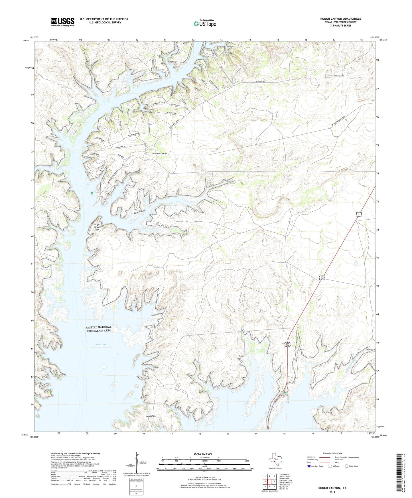
2022 topographic map quadrangle Rough Canyon in the state of Texas. Scale: 1:24000. Based on the newly updated USGS 7.5' US Topo map series, this map is in the following counties: Val Verde. The map contains contour data, water features, and other items you are used to seeing on USGS maps, but also has updated roads and other features. This is the next generation of topographic maps. Printed on high-quality waterproof paper with UV fade-resistant inks.
Quads adjacent to this one:
West: California Creek
Northwest: Gillis Ranch
North: Satan Canyon
Northeast: Miers Ranch
East: Rough Canyon SE
Southeast: Del Rio NE
South: Del Rio NW
Southwest: Amistad Dam
This map covers the same area as the classic USGS quad with code o29100e8.
Contains the following named places: Big Canyon, Devils Shores, Long Point, North Fork San Pedro Creek, Rough Canyon, Rough Canyon Cliffs, Rough Canyon Colonia, Rough Canyon Marina, Rough Canyon Recreational Area, Twin Canyons, Val Verde County Rural Volunteer Fire Department Station 3, Walk Lake, Windmill Canyon