MyTopo
Detroit Texas US Topo Map
Couldn't load pickup availability
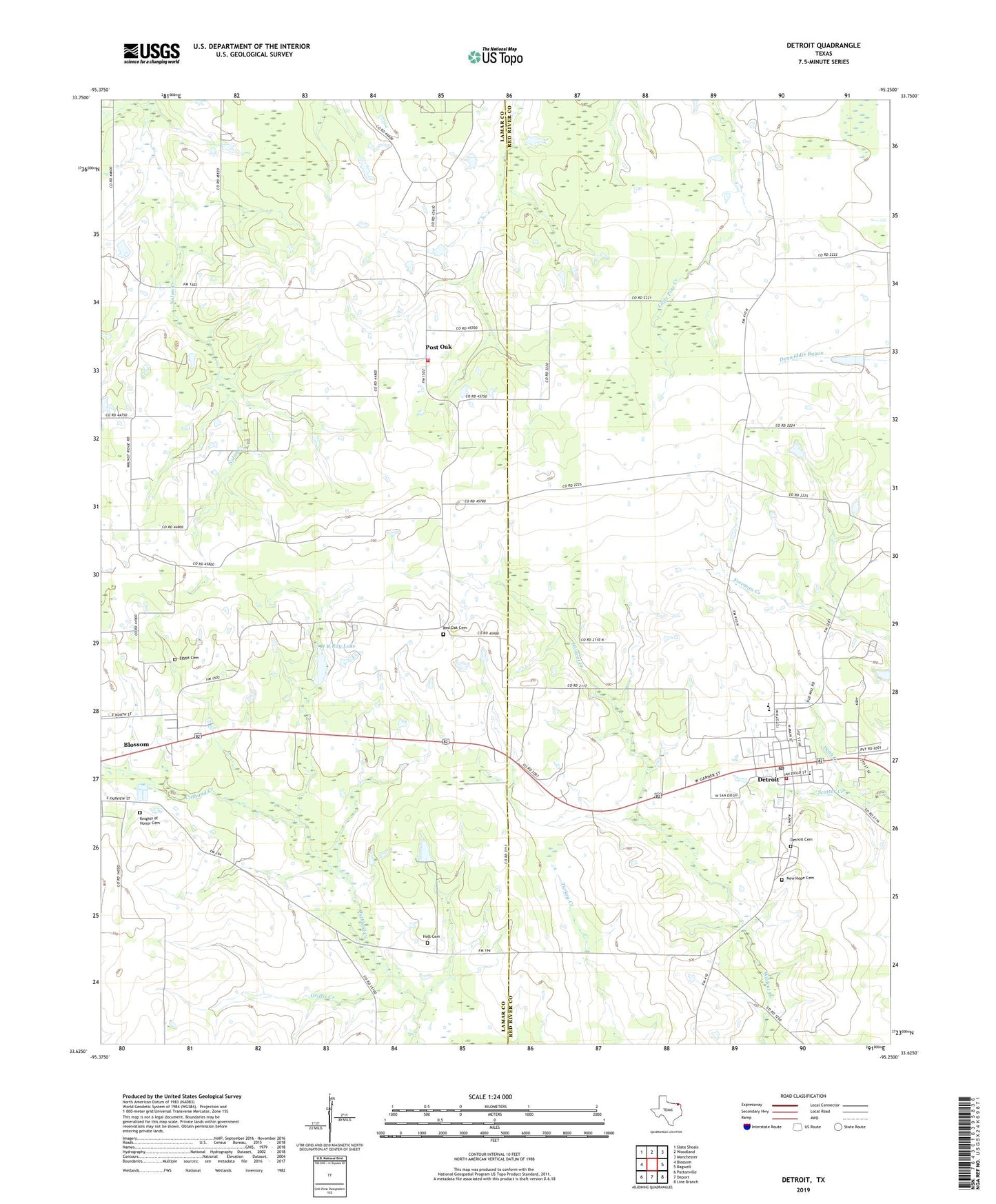
2019 topographic map quadrangle Detroit in the state of Texas. Scale: 1:24000. Based on the newly updated USGS 7.5' US Topo map series, this map is in the following counties: Lamar, Red River. The map contains contour data, water features, and other items you are used to seeing on USGS maps, but also has updated roads and other features. This is the next generation of topographic maps. Printed on high-quality waterproof paper with UV fade-resistant inks.
Quads adjacent to this one:
West: Blossom
Northwest: Slate Shoals
North: Woodland
Northeast: Manchester
East: Bagwell
Southeast: Line Branch
South: Deport
Southwest: Pattonville
Contains the following named places: Blossom Division, Cross Road, Dean Creek, Detroit, Detroit Cemetery, Detroit Elementary School, Detroit High School, Detroit Middle School, Detroit Post Office, Detroit Volunteer Fire Department, East Post Oak Cemetery, East Post Oak Volunteer Fire Department, Egypt Cemetery, Griffis Creek, Holt Cemetery, J R Ray Lake, J R Ray Lake Dam, Knights Of Honor Cemetery, New Hope Cemetery, New Hope Church, Old Blossom Cemetery, Post Oak, Red Oak Cemetery, Town of Detroit, Walnut Ridge, ZIP Code: 75416