MyTopo
Line Branch Texas US Topo Map
Couldn't load pickup availability
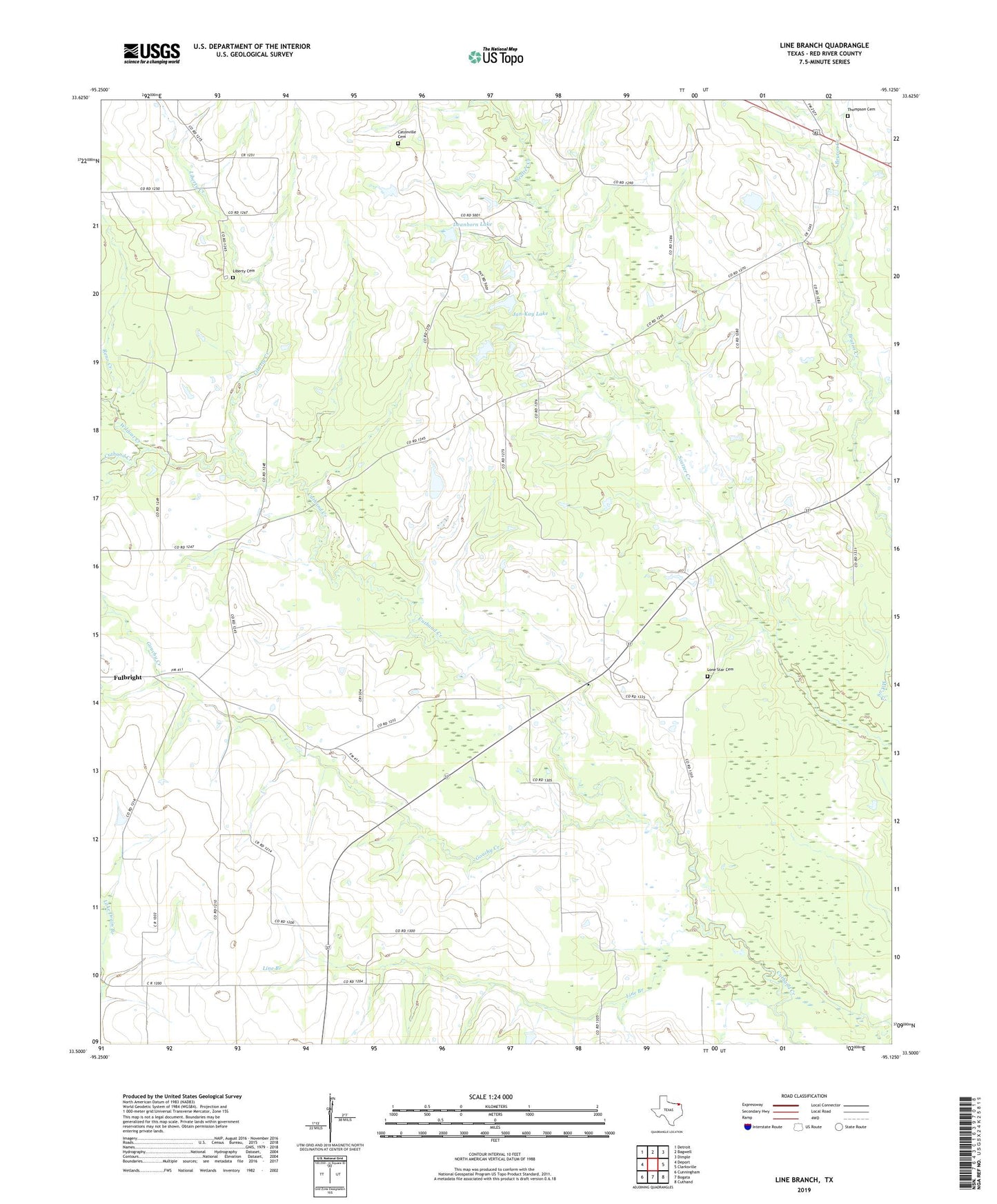
2022 topographic map quadrangle Line Branch in the state of Texas. Scale: 1:24000. Based on the newly updated USGS 7.5' US Topo map series, this map is in the following counties: Red River. The map contains contour data, water features, and other items you are used to seeing on USGS maps, but also has updated roads and other features. This is the next generation of topographic maps. Printed on high-quality waterproof paper with UV fade-resistant inks.
Quads adjacent to this one:
West: Deport
Northwest: Detroit
North: Bagwell
Northeast: Dimple
East: Clarksville
Southeast: Cuthand
South: Bogata
Southwest: Cunningham
This map covers the same area as the classic USGS quad with code o33095e2.
Contains the following named places: Catonville Cemetery, Deanborn Lake, Dearborn Lake Dam, Gouchy Creek, Jan-Kay Lake, Jan-Kay Lake Dam, Liberty, Liberty Cemetery, Liberty Creek, Line Branch, Lone Star, Lone Star Cemetery, McCoy, Reno Creek, Thompson Cemetery, Wildcat Creek