MyTopo
Dew Texas US Topo Map
Couldn't load pickup availability
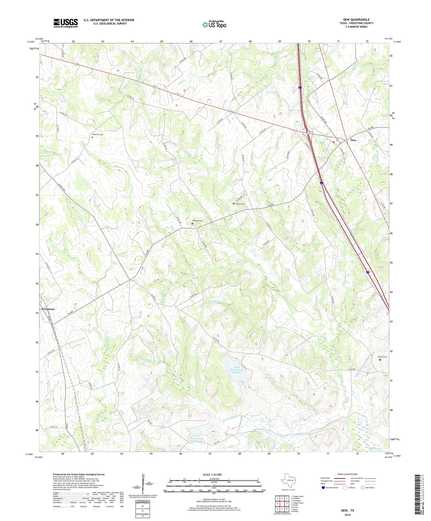
2019 topographic map quadrangle Dew in the state of Texas. Scale: 1:24000. Based on the newly updated USGS 7.5' US Topo map series, this map is in the following counties: Freestone. The map contains contour data, water features, and other items you are used to seeing on USGS maps, but also has updated roads and other features. This is the next generation of topographic maps. Printed on high-quality waterproof paper with UV fade-resistant inks.
Quads adjacent to this one:
West: Teague South
Northwest: Teague North
North: Fairfield
Northeast: Turlington
East: Lanely
Southeast: Buffalo
South: Donie
Southwest: Farrar
Contains the following named places: Antioch Church, Avant Prairie, Bee Branch, Bell Branch, Blain Dugout, Bob Branch, Caroline Creek, Cedar Creek, Cedar Dugout, Church Creek, Dew, Dew Volunteer Fire Department, Dry Creek, Fairfield Library, Freestone, Graveyard Branch, Hayes Branch, Hunt Ranch Lake Dam Number 1, Hunt Ranch Lake Dam Number 2, Hunt Ranch Lake Number 1, Hunt Ranch Lake Number 2, Kendrick Cemetery, Linn Creek, Luna, North Fork Buffalo Creek, Philpott Cemetery, Pine Branch, Salem Cemetery, Salem Church, Teague Division, Varnell Cemetery, Wilkerson Spring Branch, ZIP Code: 75860