MyTopo
Lanely Texas US Topo Map
Couldn't load pickup availability
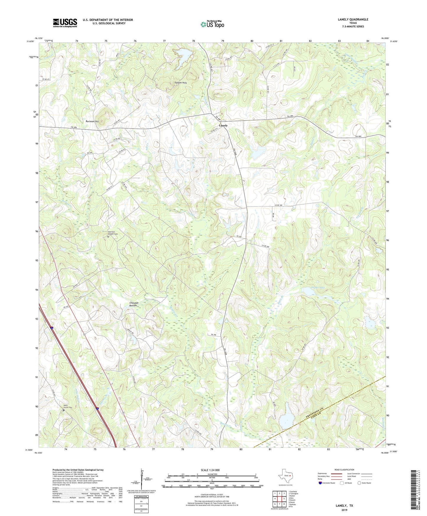
2022 topographic map quadrangle Lanely in the state of Texas. Scale: 1:24000. Based on the newly updated USGS 7.5' US Topo map series, this map is in the following counties: Freestone, Leon. The map contains contour data, water features, and other items you are used to seeing on USGS maps, but also has updated roads and other features. This is the next generation of topographic maps. Printed on high-quality waterproof paper with UV fade-resistant inks.
Quads adjacent to this one:
West: Dew
Northwest: Fairfield
North: Turlington
Northeast: Butler
East: Keechi
Southeast: Flo
South: Buffalo
Southwest: Donie
This map covers the same area as the classic USGS quad with code o31096e1.
Contains the following named places: Burleson Hill, Chandler Bottom, Concord, Dottie Branch, Folsom Hills, Fulks Dugout, Harrison Chapel Cemetery, Holly Grove Cemetery, Lanely, Little Star Church, Marshy Springs, Mount Pleasant Church, Plum Creek, Plum Creek Ranch Dam, Plum Creek Ranch Lake, Self Creek, Snider Lake Dam, Snyder Lake, Texas No Name Number 12 Dam