MyTopo
Teague North Texas US Topo Map
Couldn't load pickup availability
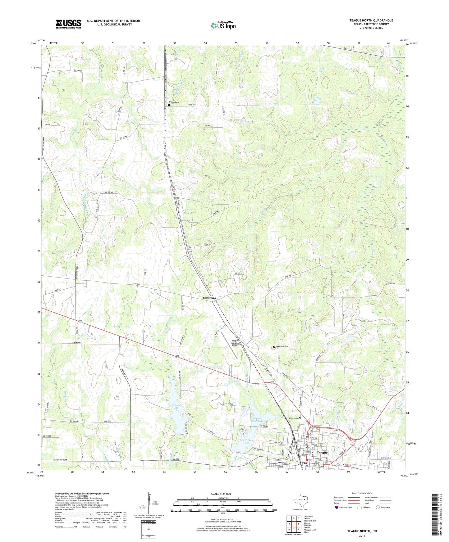
2022 topographic map quadrangle Teague North in the state of Texas. Scale: 1:24000. Based on the newly updated USGS 7.5' US Topo map series, this map is in the following counties: Freestone. The map contains contour data, water features, and other items you are used to seeing on USGS maps, but also has updated roads and other features. This is the next generation of topographic maps. Printed on high-quality waterproof paper with UV fade-resistant inks.
Quads adjacent to this one:
West: Mexia
Northwest: Wortham
North: Kirvin
Northeast: Stewards Mill
East: Fairfield
Southeast: Dew
South: Teague South
Southwest: Fallon
This map covers the same area as the classic USGS quad with code o31096f3.
Contains the following named places: Antioch Cemetery, Bi-Stone Oil Field, Booker T Washington School, Burlington-Rock Island Railroad Museum, Church of Christ, City Lake Dam, City of Teague, Cotton Gin, Crescent Chapel, Furney-Richardson School, Gibson Chapel, Gregory Field, Hausler Creek, Hopewell Cemetery, Jones Lake, Jones Lake Dam, Lower Club Lake, Lower Club Lake Dam, Saint Marys Catholic Church, Sallie Mounger Elementary School, Shanks Cemetery, Simsboro, Teague, Teague City Hall, Teague City Lake, Teague District Emergency Medical Services, Teague Municipal Airport, Teague Police Department, Teague Post Office, Teague Volunteer Fire Department, Tidus Chapel, Trinity and Brazos Valley Railroad Depot and Office Building, Union Prim Church, Upper Club Lake, Upper Club Lake Dam, Wesley Church, Westside Church of Christ