
MyTopo
Dilley Texas US Topo Map
Couldn't load pickup availability
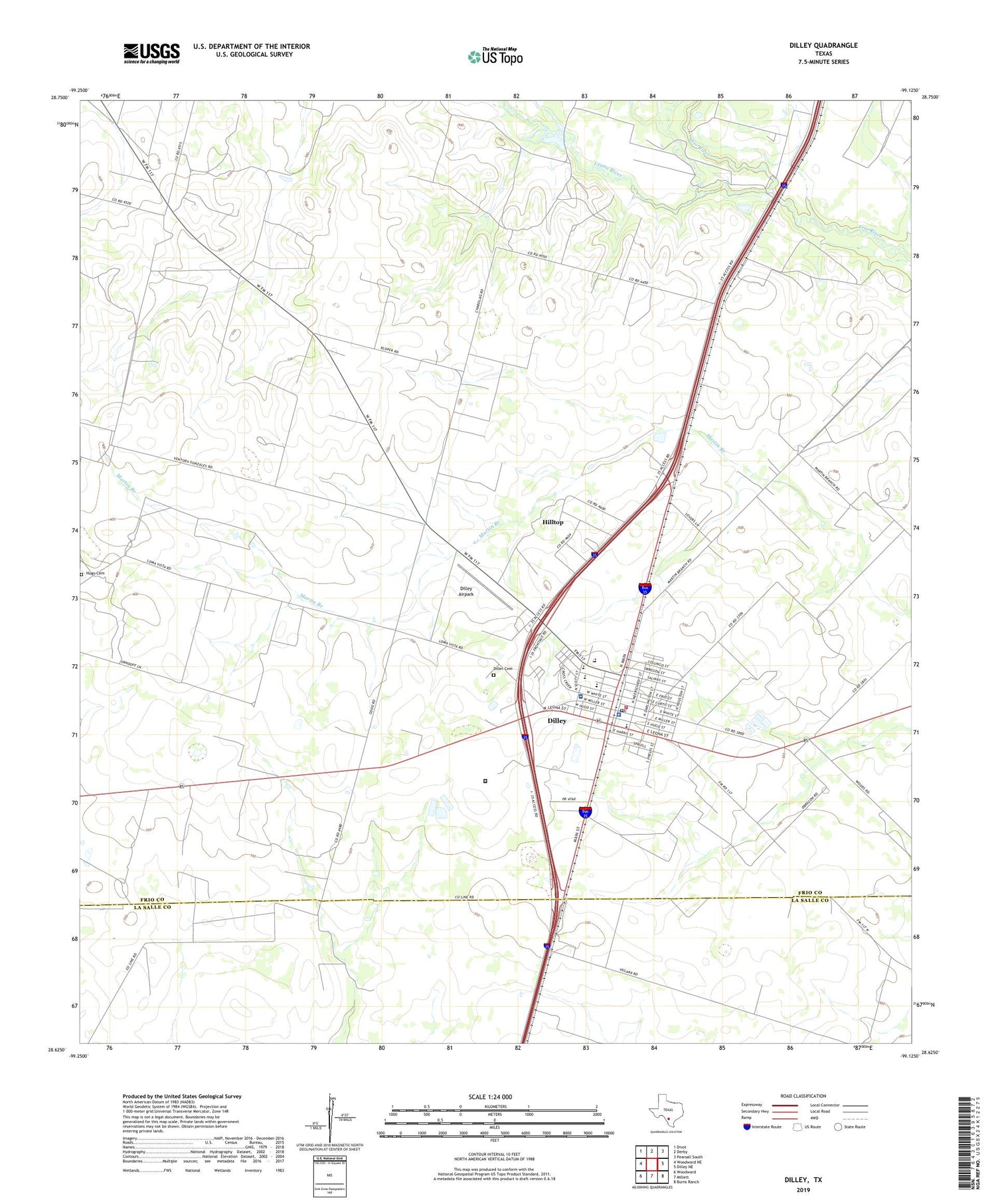
2019 topographic map quadrangle Dilley in the state of Texas. Scale: 1:24000. Based on the newly updated USGS 7.5' US Topo map series, this map is in the following counties: Frio, La Salle. The map contains contour data, water features, and other items you are used to seeing on USGS maps, but also has updated roads and other features. This is the next generation of topographic maps. Printed on high-quality waterproof paper with UV fade-resistant inks.
Quads adjacent to this one:
West: Woodward NE
Northwest: Divot
North: Derby
Northeast: Pearsall South
East: Dilley NE
Southeast: Burns Ranch
South: Millett
Southwest: Woodward
Contains the following named places: Bennett Reservoir, City of Dilley, Derby Dam, Diller Cemetery, Dilley, Dilley Airpark, Dilley City Hall, Dilley City Park, Dilley Elementary School, Dilley Police Department, Dilley Post Office, Dilley Volunteer Fire Department, Frio County Constable's Office Precinct 4, Gosch Athletic Field, Hilltop, Hilltop Census Designated Place, Hilltop Colonia, Hugo Cemetery, Leona River, Mary Harper Middle School, Nix Community General Hospital, Texas Department of Criminal Justice Dolph Briscoe Unit, Winter Garden Rodeo Ground, ZIP Code: 78017


