MyTopo
Derby Texas US Topo Map
Couldn't load pickup availability
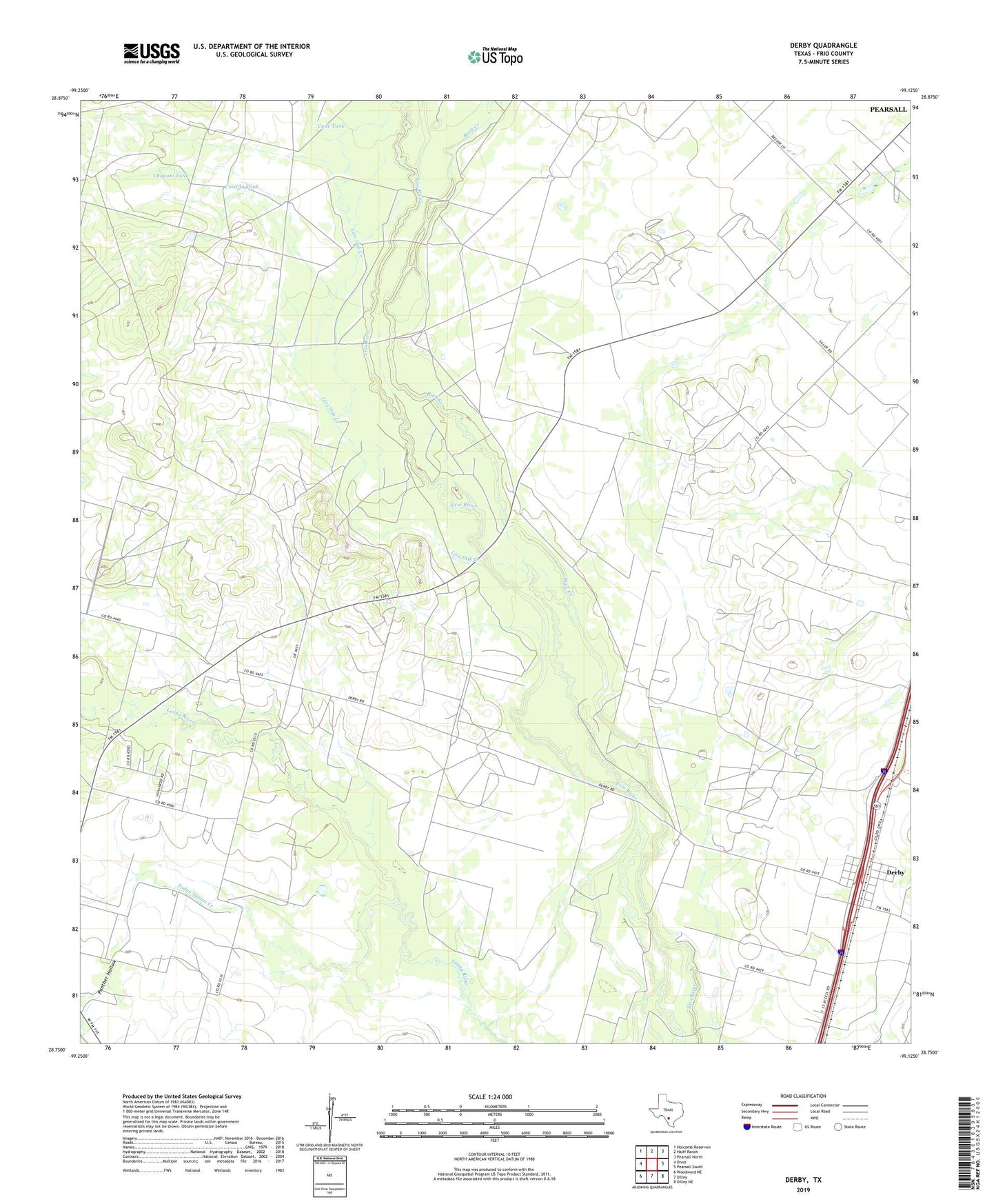
2022 topographic map quadrangle Derby in the state of Texas. Scale: 1:24000. Based on the newly updated USGS 7.5' US Topo map series, this map is in the following counties: Frio. The map contains contour data, water features, and other items you are used to seeing on USGS maps, but also has updated roads and other features. This is the next generation of topographic maps. Printed on high-quality waterproof paper with UV fade-resistant inks.
Quads adjacent to this one:
West: Divot
Northwest: Holcomb Reservoir
North: Halff Ranch
Northeast: Pearsall North
East: Pearsall South
Southeast: Dilley NE
South: Dilley
Southwest: Woodward NE
This map covers the same area as the classic USGS quad with code o28099g2.
Contains the following named places: Abispa Windmill, Brushy Windmill, Buck Creek, Chapote Tank, Chivo Windmill, Costilla Tank, Cude Tank, Derby, Derby Colonia, Herbert Windmill, Honeymoon Windmill, Jesse Windmill, Live Oak Creek, Oil Field Windmill, Panther Hollow, Pearsall Oil Field, Penn Windmill, Round Mountain Windmill, Sing Windmill, Todos Santos Creek, Upper Brushy Windmill, Zartuche Windmill