MyTopo
Divide Country Texas US Topo Map
Couldn't load pickup availability
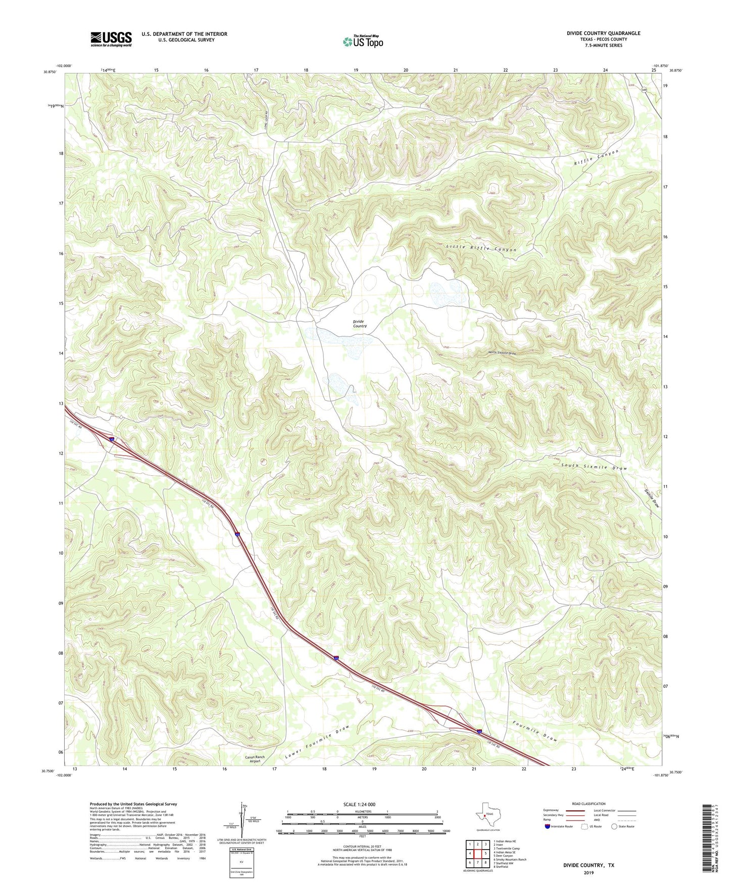
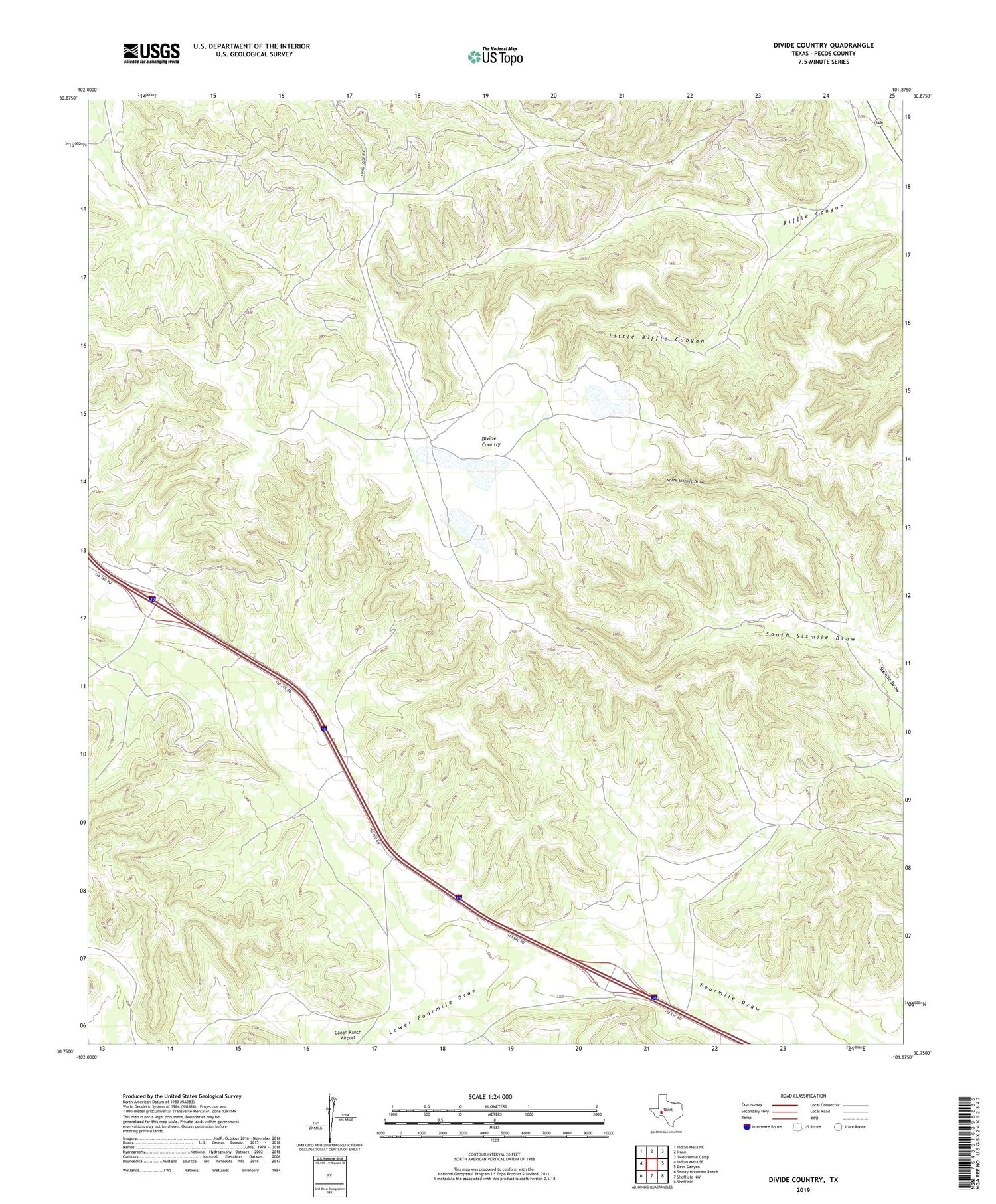
2019 topographic map quadrangle Divide Country in the state of Texas. Scale: 1:24000. Based on the newly updated USGS 7.5' US Topo map series, this map is in the following counties: Pecos. The map contains contour data, water features, and other items you are used to seeing on USGS maps, but also has updated roads and other features. This is the next generation of topographic maps. Printed on high-quality waterproof paper with UV fade-resistant inks.
Quads adjacent to this one:
West: Indian Mesa SE
Northwest: Indian Mesa NE
North: Iraan
Northeast: Twelvemile Camp
East: Deer Canyon
Southeast: Sheffield
South: Sheffield NW
Southwest: Smoky Mountain Ranch
Contains the following named places: Divide Country, Little Riffle Canyon, Lower Fourmile Draw, North Sixmile Draw, South Sixmile Draw