MyTopo
Sheffield Texas US Topo Map
Couldn't load pickup availability
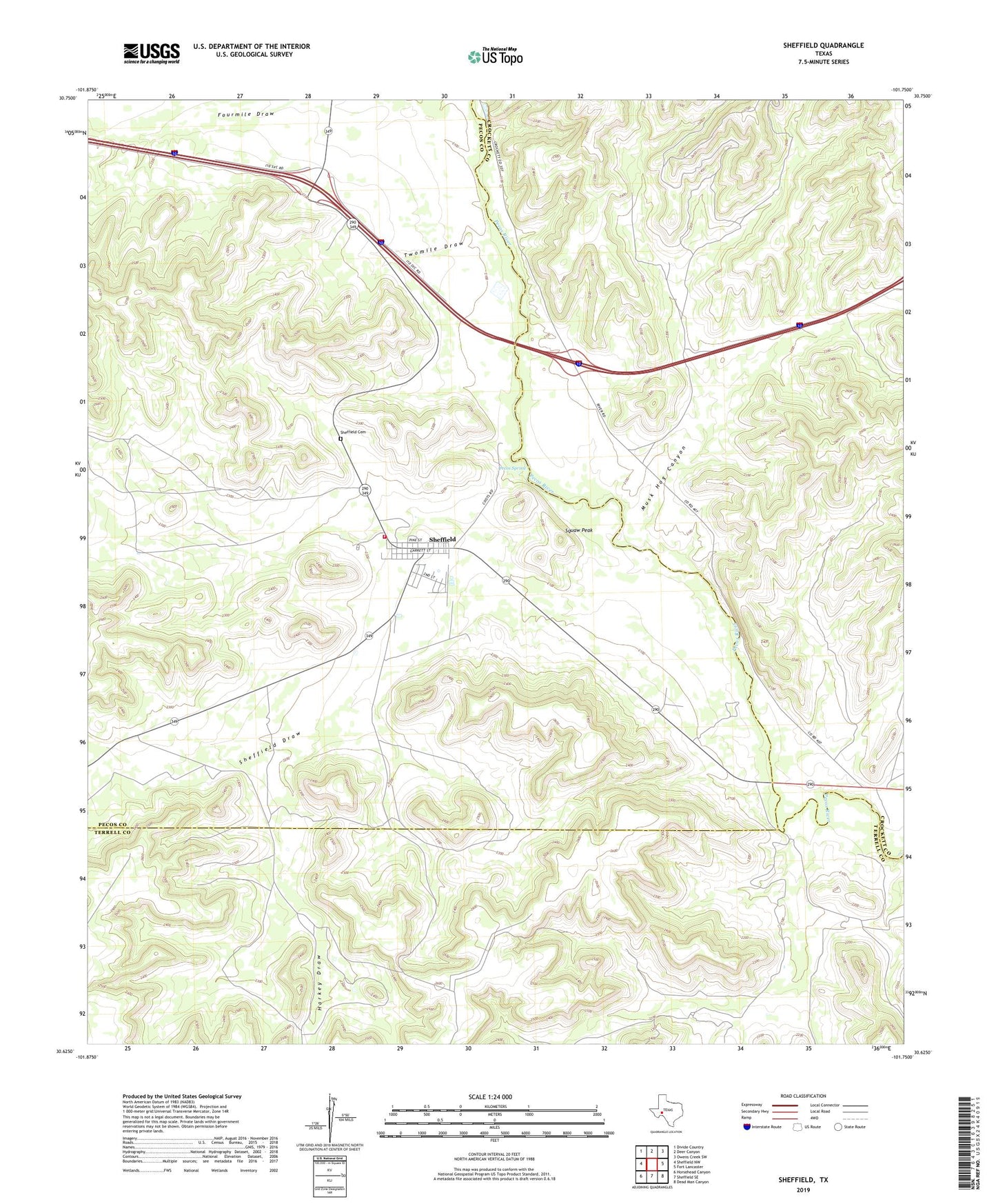
2023 topographic map quadrangle Sheffield in the state of Texas. Scale: 1:24000. Based on the newly updated USGS 7.5' US Topo map series, this map is in the following counties: Pecos, Crockett, Terrell. The map contains contour data, water features, and other items you are used to seeing on USGS maps, but also has updated roads and other features. This is the next generation of topographic maps. Printed on high-quality waterproof paper with UV fade-resistant inks.
Quads adjacent to this one:
West: Sheffield NW
Northwest: Divide Country
North: Deer Canyon
Northeast: Owens Creek SW
East: Fort Lancaster
Southeast: Dead Man Canyon
South: Sheffield SE
Southwest: Horsehead Canyon
This map covers the same area as the classic USGS quad with code o30101f7.
Contains the following named places: Banner Canyon Windmill, Banner Trap Windmill, Cripple Goose Windmill, Halff Oil Field, Harkey Draw, Harkey Windmill, Harkey-Banner Windmill, Musk Hog Canyon, Pecos Spring, Saddle Ridge Windmill, Sheffield, Sheffield Cemetery, Sheffield Census Designated Place, Sheffield Draw, Sheffield Post Office, Sheffield Volunteer Fire Department and Emergency Medical Services, Squaw Peak, Twomile Draw