MyTopo
Donie Texas US Topo Map
Couldn't load pickup availability
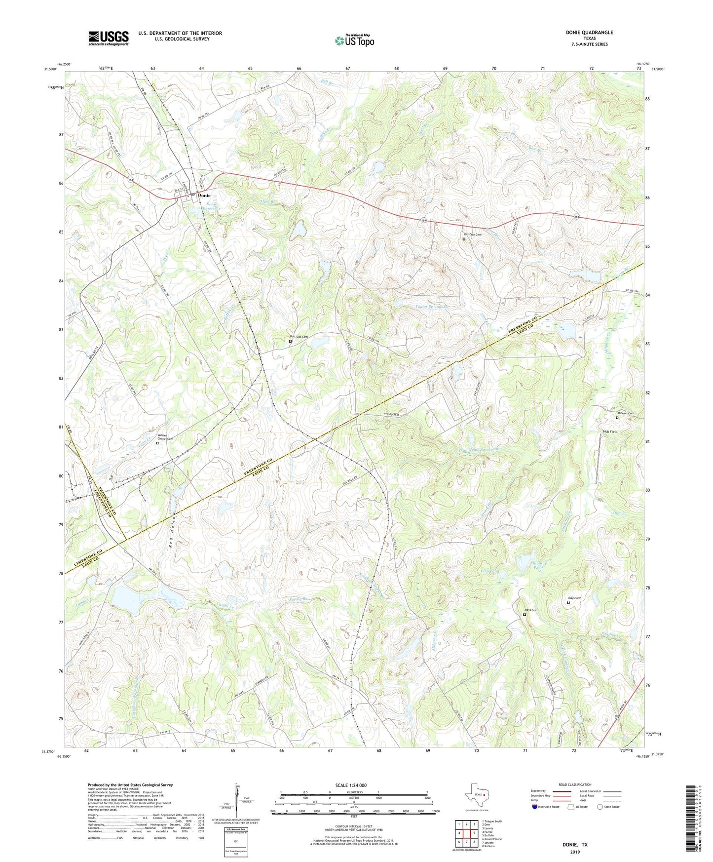
2019 topographic map quadrangle Donie in the state of Texas. Scale: 1:24000. Based on the newly updated USGS 7.5' US Topo map series, this map is in the following counties: Leon, Freestone, Limestone. The map contains contour data, water features, and other items you are used to seeing on USGS maps, but also has updated roads and other features. This is the next generation of topographic maps. Printed on high-quality waterproof paper with UV fade-resistant inks.
Quads adjacent to this one:
West: Farrar
Northwest: Teague South
North: Dew
Northeast: Lanely
East: Buffalo
Southeast: Robbins
South: Jewett
Southwest: Round Prairie
Contains the following named places: Alligator Pond, Alum Branch, Cottonwood Springs Branch, Donie, Donie Post Office, Donie Reservoir, Duck Pond, Flag Pond, Hub Field, Jackson Cemetery, Mays Cemetery, Nanny Branch, Needham Marsh Branch, New Spring Seat Church, Old Zion Cemetery, Panther Creek, Post Oak Cemetery, Red Hollow, Riley Springs Well, Silver Creek, Spring Branch, Spring Seat Church, Tape Creek, Taylor Lake, Taylor Springs Branch, Thundering Springs Branch, West Fork Panther Creek, Wilson Chapel, Wilsons Chapel Cemetery, ZIP Code: 75838