MyTopo
Robbins Texas US Topo Map
Couldn't load pickup availability
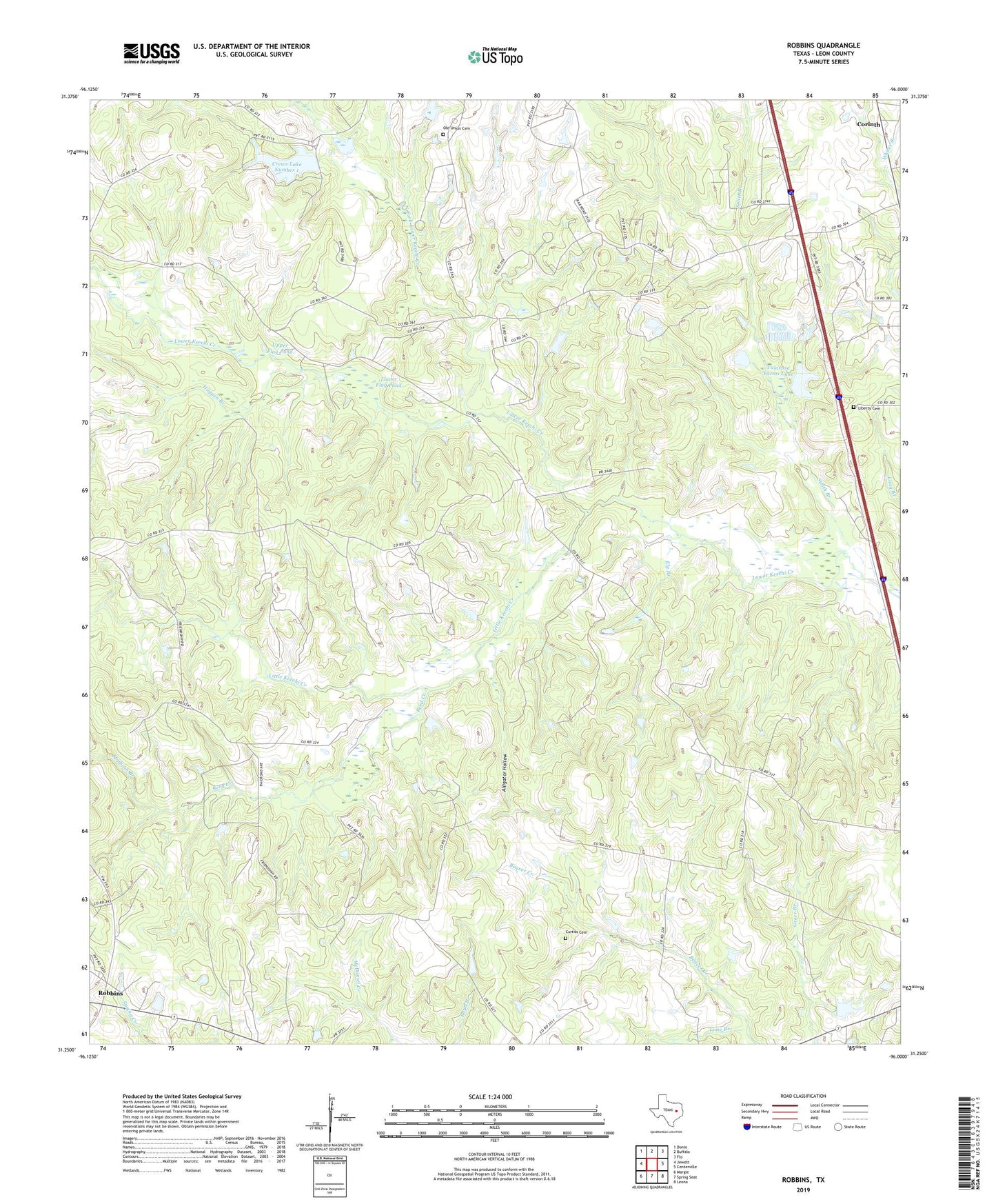
2022 topographic map quadrangle Robbins in the state of Texas. Scale: 1:24000. Based on the newly updated USGS 7.5' US Topo map series, this map is in the following counties: Leon. The map contains contour data, water features, and other items you are used to seeing on USGS maps, but also has updated roads and other features. This is the next generation of topographic maps. Printed on high-quality waterproof paper with UV fade-resistant inks.
Quads adjacent to this one:
West: Jewett
Northwest: Donie
North: Buffalo
Northeast: Flo
East: Centerville
Southeast: Leona
South: Spring Seat
Southwest: Margie
This map covers the same area as the classic USGS quad with code o31096c1.
Contains the following named places: Alligator Hollow, Corinth, Crews Lake Number 1, Crews Lake Number 1 Dam, Curtiss Cemetery, Curtiss Spring Branch, Ely Branch, Friendship, Hogpen Branch, Liberty Cemetery, Lime Branch, Little Keechi Creek, Lower Flag Pond, Madison Branch, Mount Lily Church, North Fork Lower Keechi Creek, North Salem, Old Union Cemetery, Reed Creek, Robbins, Simpson Branch, Smith Branch, South Salem, Tularosa Farms Lake, Tularosa Farms Lake Dam, Upper Flag Pond, Whites Branch