MyTopo
Double Mountains Texas US Topo Map
Couldn't load pickup availability
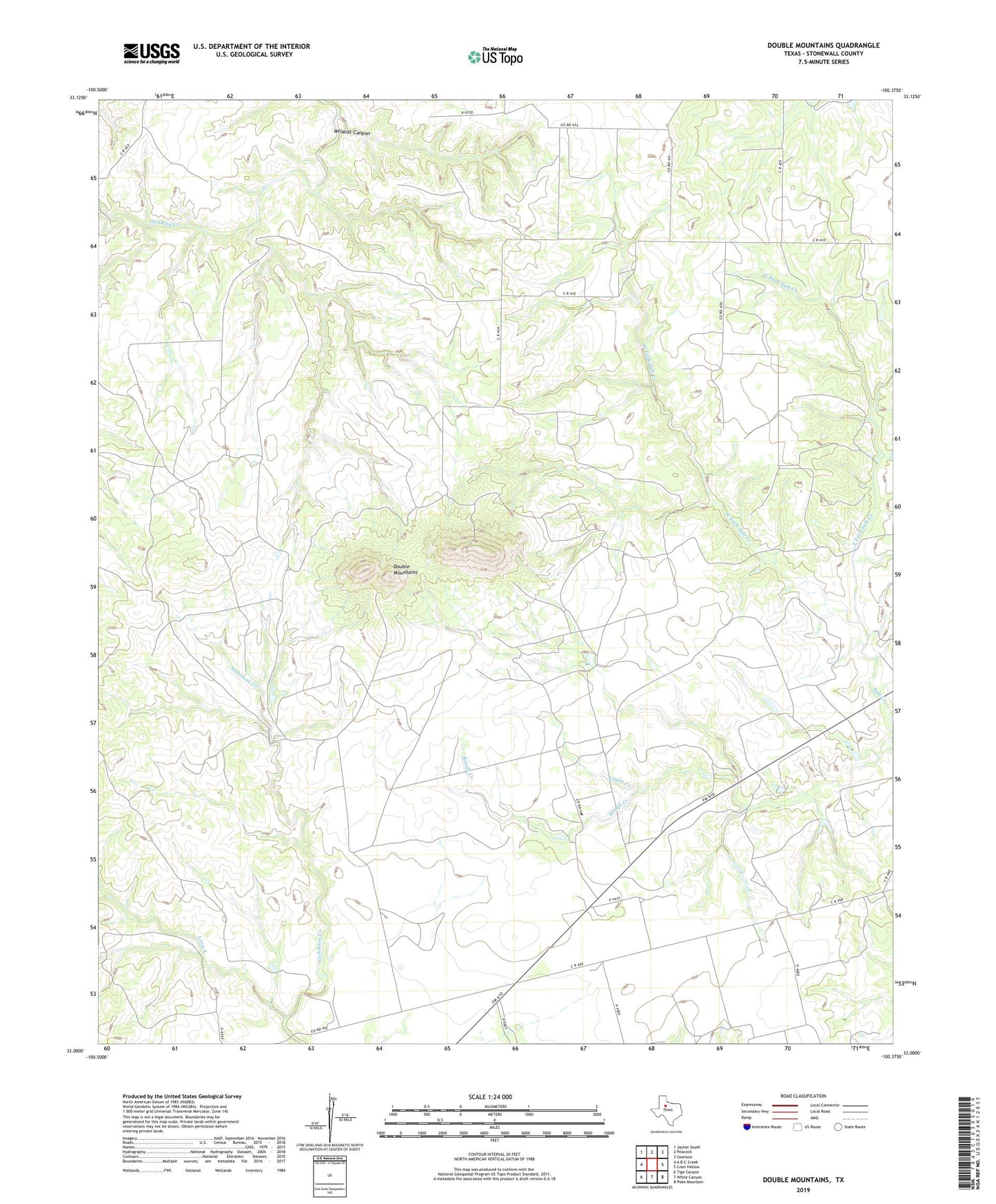
2019 topographic map quadrangle Double Mountains in the state of Texas. Scale: 1:24000. Based on the newly updated USGS 7.5' US Topo map series, this map is in the following counties: Stonewall. The map contains contour data, water features, and other items you are used to seeing on USGS maps, but also has updated roads and other features. This is the next generation of topographic maps. Printed on high-quality waterproof paper with UV fade-resistant inks.
Quads adjacent to this one:
West: A B C Creek
Northwest: Jayton South
North: Peacock
Northeast: Swenson
East: Coon Hollow
Southeast: Poke Mountain
South: White Canyon
Southwest: Tige Canyon
Contains the following named places: Bough Creek, Count Creek, Dorras, Double Mountains, East Fork Salt Creek, Long A, West Fork Salt Creek, Wildcat Canyon