MyTopo
Coon Hollow Texas US Topo Map
Couldn't load pickup availability
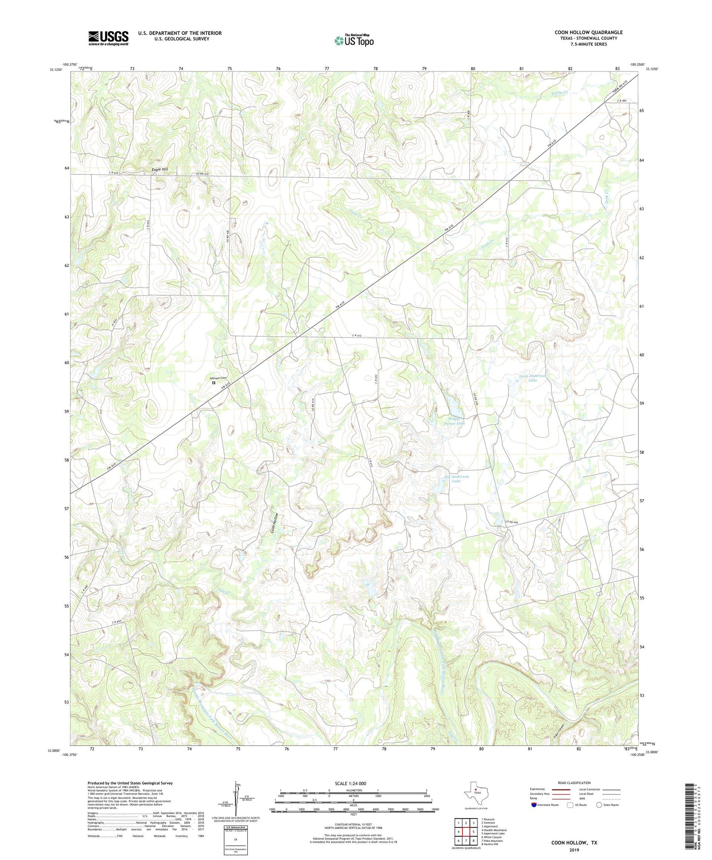
2022 topographic map quadrangle Coon Hollow in the state of Texas. Scale: 1:24000. Based on the newly updated USGS 7.5' US Topo map series, this map is in the following counties: Stonewall. The map contains contour data, water features, and other items you are used to seeing on USGS maps, but also has updated roads and other features. This is the next generation of topographic maps. Printed on high-quality waterproof paper with UV fade-resistant inks.
Quads adjacent to this one:
West: Double Mountains
Northwest: Peacock
North: Swenson
Northeast: Aspermont
East: Aspermont Lake
Southeast: Hamlin NW
South: Poke Mountain
Southwest: White Canyon
This map covers the same area as the classic USGS quad with code o33100a3.
Contains the following named places: Aspermont South Division, Coon Hollow, Eagle Hill, Jim Anderson Lake, Jim Anderson Lake Dam, Johnson Chapel Cemetery, Johnson Church, Lee Family Cemetery, Leon Anderson Lake, Leon Anderson Lake Dam, Poke Canyon, Porter Lake, Porter Lake Dam, Salt Creek, Wayne Porter Lake, Wayne Porter Lake Dam