
MyTopo
Dumont Texas US Topo Map
Couldn't load pickup availability
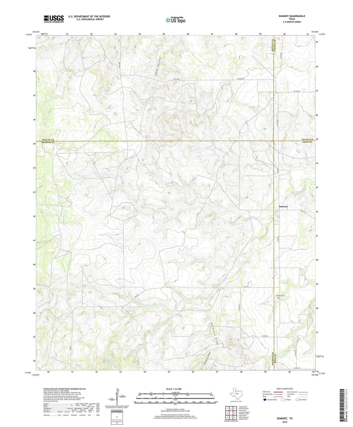
2019 topographic map quadrangle Dumont in the state of Texas. Scale: 1:24000. Based on the newly updated USGS 7.5' US Topo map series, this map is in the following counties: Dickens, Motley, King, Cottle. The map contains contour data, water features, and other items you are used to seeing on USGS maps, but also has updated roads and other features. This is the next generation of topographic maps. Printed on high-quality waterproof paper with UV fade-resistant inks.
Quads adjacent to this one:
West: Sanders Hollow
Northwest: Russellville
North: China Canyon
Northeast: Grow NW
East: Buffalo Creek
Southeast: Guthrie NW
South: East Afton NE
Southwest: East Afton
Contains the following named places: Deep Well, Dillar Windmill, Dumont, Dumont Cemetery, Dumont Horse Pasture Windmill, Eighteen Creek, Eighteen Creek Windmill, Headquarters Windmill, McDuff Windmill, Middle Creek, Middle Creek Windmill, Sandy Well, Section Seven Windmill, Shinnery Draw, Shinnery Springs, South East Thief Hollow Windmill, South River Windmill, Southeast River Windmill, Thief Hollow Windmill, Threeway Windmill, Wildcat Draw


