MyTopo
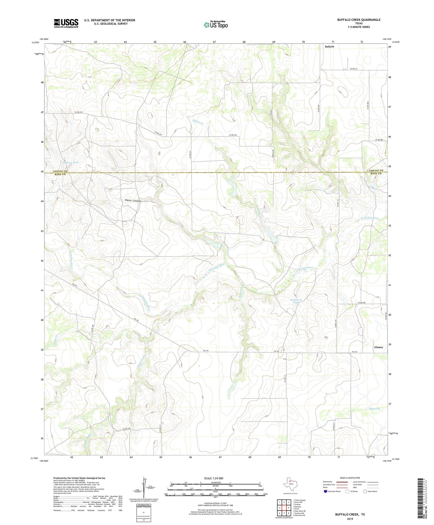
Buffalo Creek Texas US Topo Map
Couldn't load pickup availability
2022 topographic map quadrangle Buffalo Creek in the state of Texas. Scale: 1:24000. Based on the newly updated USGS 7.5' US Topo map series, this map is in the following counties: King, Cottle. The map contains contour data, water features, and other items you are used to seeing on USGS maps, but also has updated roads and other features. This is the next generation of topographic maps. Printed on high-quality waterproof paper with UV fade-resistant inks.
Quads adjacent to this one:
West: Dumont
Northwest: China Canyon
North: Grow NW
Northeast: Ginsite
East: Grow
Southeast: Fourmile Hill
South: Guthrie NW
Southwest: East Afton NE
This map covers the same area as the classic USGS quad with code o33100g4.
Contains the following named places: Buffalo Creek, Buffalo Windmill, Camp Hollar Windmill, Cottonwood Creek, Dewees Tank, Dewees Windmill, Doc Green Windmill, Drummonds Windmill, Finney, Hackberry Tank, Hollar Creek, Robertson Windmill, Roosevelt Windmill, Sand Well Windmill, Snakey Futch Windmill, Sweetness Windmill, Water Canyon, Willow Creek