MyTopo
Sanders Hollow Texas US Topo Map
Couldn't load pickup availability
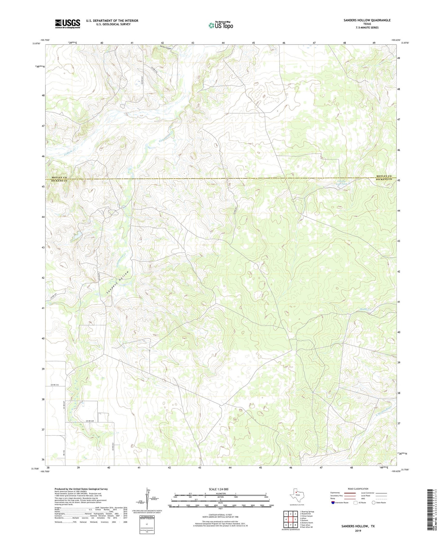
2022 topographic map quadrangle Sanders Hollow in the state of Texas. Scale: 1:24000. Based on the newly updated USGS 7.5' US Topo map series, this map is in the following counties: Dickens, Motley. The map contains contour data, water features, and other items you are used to seeing on USGS maps, but also has updated roads and other features. This is the next generation of topographic maps. Printed on high-quality waterproof paper with UV fade-resistant inks.
Quads adjacent to this one:
West: Afton
Northwest: Roaring Springs
North: Russellville
Northeast: China Canyon
East: Dumont
Southeast: East Afton NE
South: East Afton
Southwest: Dickens North
This map covers the same area as the classic USGS quad with code o33100g6.
Contains the following named places: Berry Windmill, Big E Windmill, Carolyn Windmill, Cindy Windmill, Cottonwood Creek, County Line Tank, Darden Canyon, Hoyle Windmill, James Windmill, Jobe Windmill, Lee Windmill, Mark Windmill, Old Camp Windmill, Randys Windmill, Red Lake Ranch, Sam Windmill, Sanders Hollow, Sanders Hollow Windmill, Steve Windmill