MyTopo
East Afton NE Texas US Topo Map
Couldn't load pickup availability
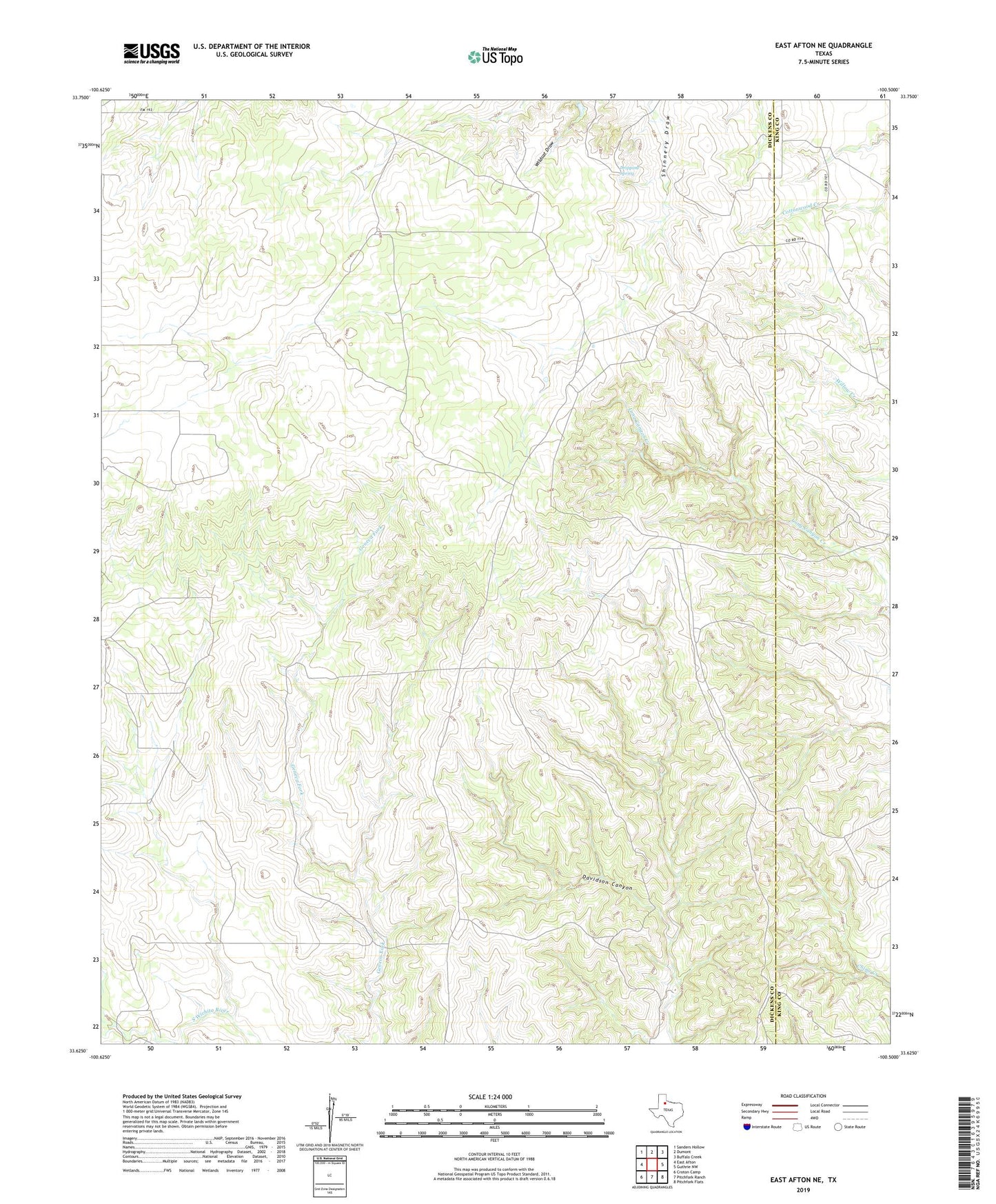
2019 topographic map quadrangle East Afton NE in the state of Texas. Scale: 1:24000. Based on the newly updated USGS 7.5' US Topo map series, this map is in the following counties: Dickens, King. The map contains contour data, water features, and other items you are used to seeing on USGS maps, but also has updated roads and other features. This is the next generation of topographic maps. Printed on high-quality waterproof paper with UV fade-resistant inks.
Quads adjacent to this one:
West: East Afton
Northwest: Sanders Hollow
North: Dumont
Northeast: Buffalo Creek
East: Guthrie NW
Southeast: Pitchfork Flats
South: Pitchfork Ranch
Southwest: Croton Camp
Contains the following named places: Cowboy Windmill, Deep Well Windmill, Dripping Spring, Gates Williams Windmill, Gene Williams Windmill, North Shinnery Windmill, Roosevelt Windmill, Scale Pen Windmill, Seaboard Windmill, South Shinnery Windmill, Stovall Windmill, Taylor Tubs Windmill, Upper Beef Pasture Windmill, Upper Davidson Windmill, Upper Long Canyon Windmill, Watson Windmill, West Gage Windmill