MyTopo
El Campo Texas US Topo Map
Couldn't load pickup availability
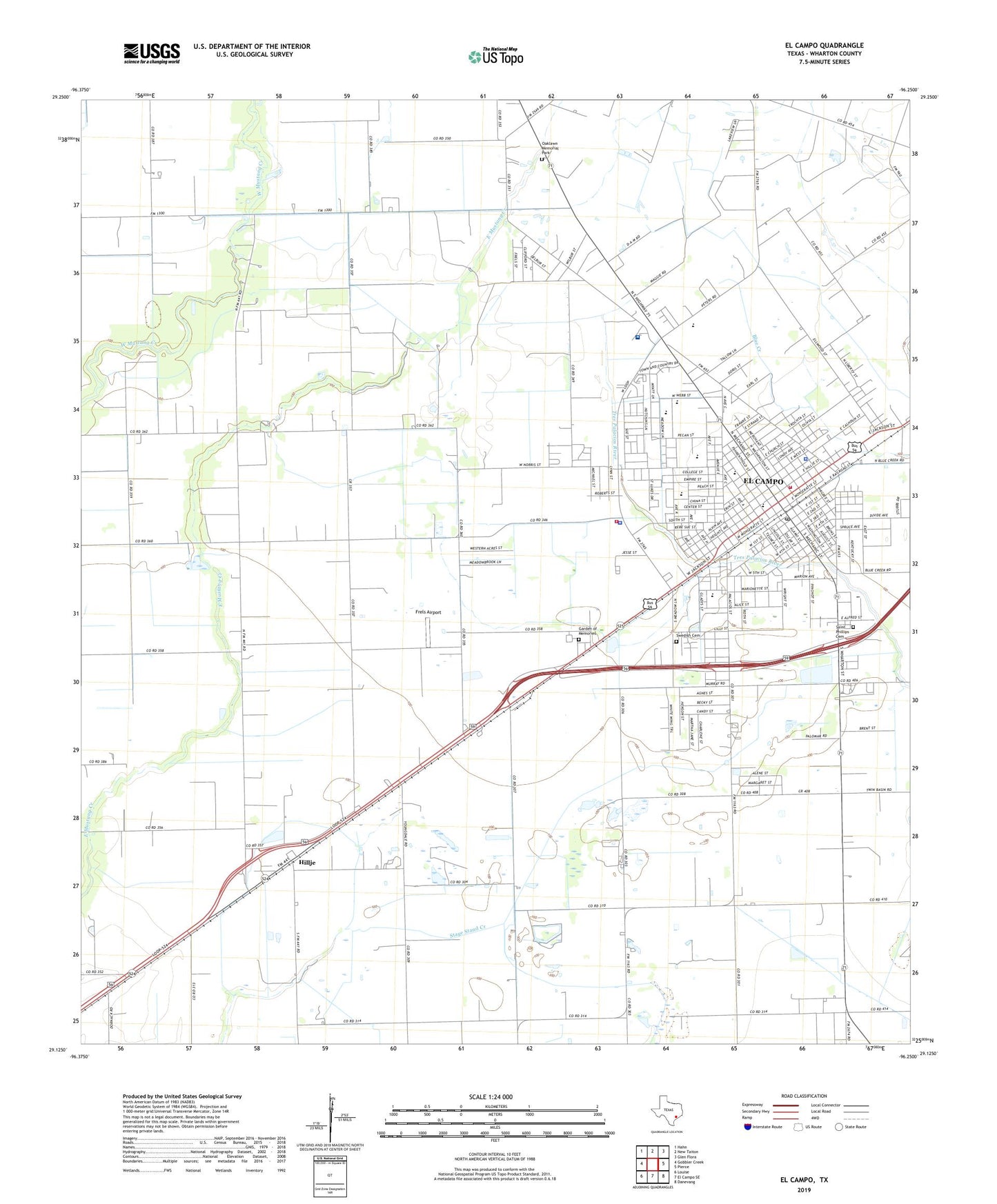
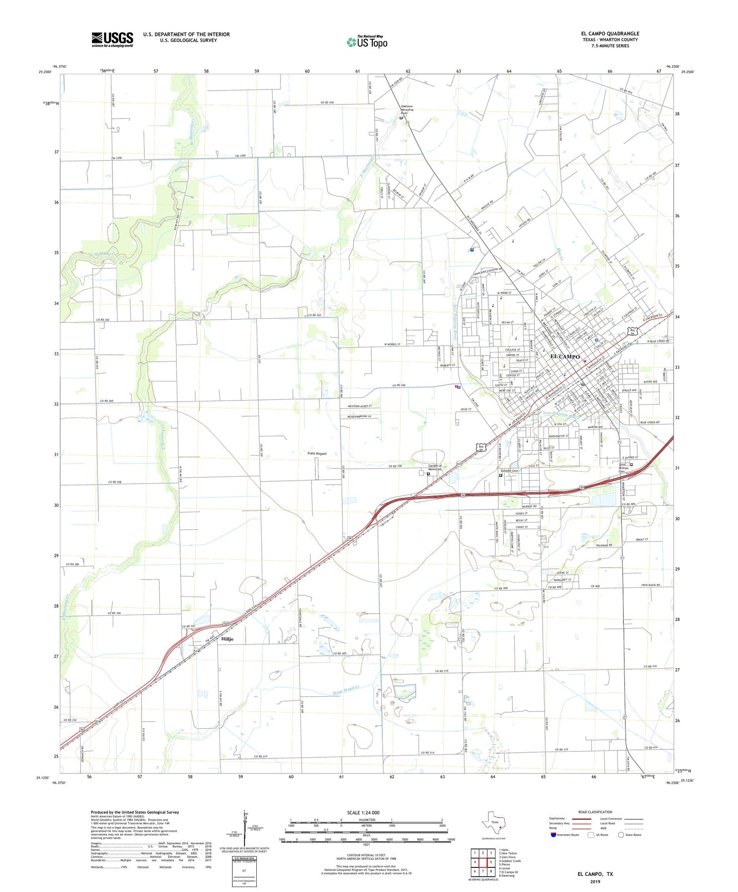
2019 topographic map quadrangle El Campo in the state of Texas. Scale: 1:24000. Based on the newly updated USGS 7.5' US Topo map series, this map is in the following counties: Wharton. The map contains contour data, water features, and other items you are used to seeing on USGS maps, but also has updated roads and other features. This is the next generation of topographic maps. Printed on high-quality waterproof paper with UV fade-resistant inks.
Quads adjacent to this one:
West: Gobbler Creek
Northwest: Hahn
North: New Taiton
Northeast: Glen Flora
East: Pierce
Southeast: Danevang
South: El Campo SE
Southwest: Louise
Contains the following named places: City of El Campo, Dornak Lake, El Campo, El Campo City Hall, El Campo Emergency Medical Services, El Campo High School, El Campo Memorial Hospital, El Campo Middle School, El Campo Museum of Art History and Natural Science, El Campo Opportunity School, El Campo Police Department, El Campo Post Office, El Campo Volunteer Fire Department, First Presbyterian Church Preschool, Frels Airport, Friendship Park, Garden of Memories, Greer School, Hillje, Hutchins Elementary School, Hutchins Oil Field, Hutchins School, KULP-AM (El Campo), Myatt Elementary School, Nightingale Hospital, North Side School, Northside Elementary School, Oaklawn Memorial Park, Ricebird Stadium, Saint Andrews Church, Saint Philip Catholic Elementary School, Saint Phillips Cemetery, South Side School, Swedish Cemetery, Wharton County Constable's Office Precinct 4, Wharton County Sheriff's Office, ZIP Code: 77437