MyTopo
New Taiton Texas US Topo Map
Couldn't load pickup availability
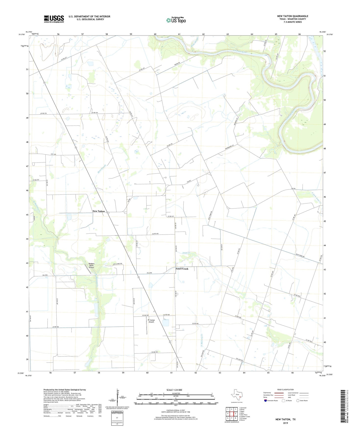
2022 topographic map quadrangle New Taiton in the state of Texas. Scale: 1:24000. Based on the newly updated USGS 7.5' US Topo map series, this map is in the following counties: Wharton. The map contains contour data, water features, and other items you are used to seeing on USGS maps, but also has updated roads and other features. This is the next generation of topographic maps. Printed on high-quality waterproof paper with UV fade-resistant inks.
Quads adjacent to this one:
West: Hahn
Northwest: Garwood
North: Bonus
Northeast: Egypt
East: Glen Flora
Southeast: Pierce
South: El Campo
Southwest: Gobbler Creek
This map covers the same area as the classic USGS quad with code o29096c3.
Contains the following named places: College Station Public Library System Building, El Campo Airpark, Jones Creek, Lakeview Meter Station, Lakeview Oil Field, Mott Slough, New Taiton, New Taiton Oil Field, Northington Lake, Robb Slough, Rodgers Roost Airport, Saint John Church, Station 30 Heliport