MyTopo
Ella Texas US Topo Map
Couldn't load pickup availability
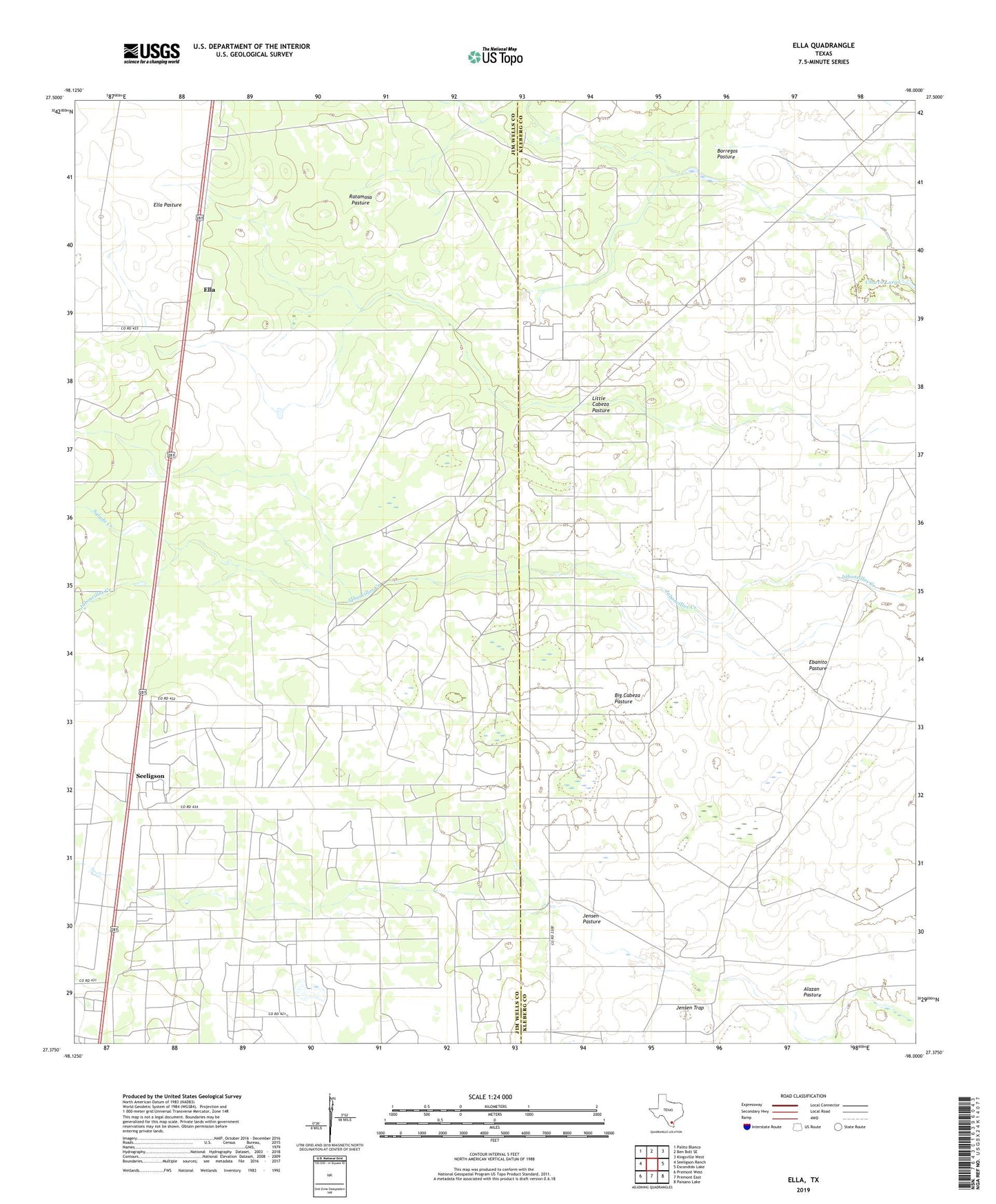
2019 topographic map quadrangle Ella in the state of Texas. Scale: 1:24000. Based on the newly updated USGS 7.5' US Topo map series, this map is in the following counties: Jim Wells, Kleberg. The map contains contour data, water features, and other items you are used to seeing on USGS maps, but also has updated roads and other features. This is the next generation of topographic maps. Printed on high-quality waterproof paper with UV fade-resistant inks.
Quads adjacent to this one:
West: Seeligson Ranch
Northwest: Palito Blanco
North: Ben Bolt SE
Northeast: Kingsville West
East: Escondido Lake
Southeast: Paisano Lake
South: Premont East
Southwest: Premont West
Contains the following named places: Big Cabeza Pasture, Big Cabeza Windmill, Borregos Lake, Borregos Pasture, Cabeza Windmill, Charco Largo, Ebanito Camp, Ebanito Pasture, Ebanito Windmill, Ella, Ella Pasture, Ella Windmill, Guajalote Windmill, Javalina Windmill, Jensen Pasture, King Ranch Windmill, Lamar Windmill, Little Cabeza Pasture, Little Cabeza Windmill, Los Voces Windmill, Nancy Windmill, New Well Windmill, Papalote de en Medio, Pens Windmill, Ratamosa Pasture, Ratamosa Windmill, Salado Creek, Seeligson