MyTopo
Premont East Texas US Topo Map
Couldn't load pickup availability
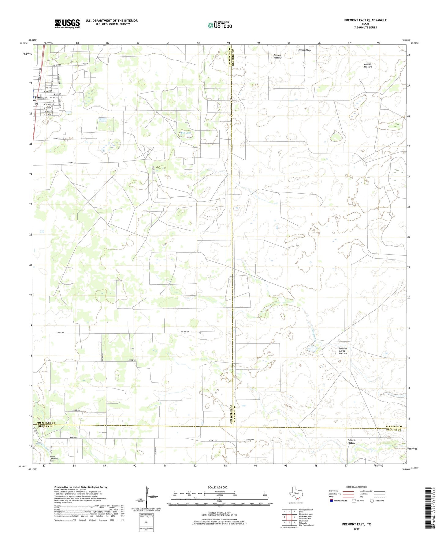
2022 topographic map quadrangle Premont East in the state of Texas. Scale: 1:24000. Based on the newly updated USGS 7.5' US Topo map series, this map is in the following counties: Jim Wells, Kleberg, Brooks. The map contains contour data, water features, and other items you are used to seeing on USGS maps, but also has updated roads and other features. This is the next generation of topographic maps. Printed on high-quality waterproof paper with UV fade-resistant inks.
Quads adjacent to this one:
West: Premont West
Northwest: Seeligson Ranch
North: Ella
Northeast: Escondido Lake
East: Paisano Lake
Southeast: La Paloma Ranch
South: Flowella
Southwest: Falfurrias
This map covers the same area as the classic USGS quad with code o27098c1.
Contains the following named places: Alazan Pasture, Big Lake, Big Lake Windmill, Canales Windmill, Cantarawas Windmill, CIG 402 Heliport, City of Premont, Cuchillo Windmill, El Cinco Windmill, El Ocho Windmill, Falfurrias Oil Field, Finados Windmill, Huisacne Windmill, Javalin Windmill, Jensen Trap, Jensen Windmill, La Labor Windmill, La Mula Windmill, La Paloma Emergency Medical Service, La Salada Windmill, Laguna Larga Pasture, Laiva Windmill, Las Comas Windmill, Los Olmos Cemetery, Paisano Windmill, Premont, Premont Post Office, Tijerina Oil Field, Tijerina-Canales-Blucher Oil Field, Vallejos Windmill