MyTopo
Emory South Texas US Topo Map
Couldn't load pickup availability
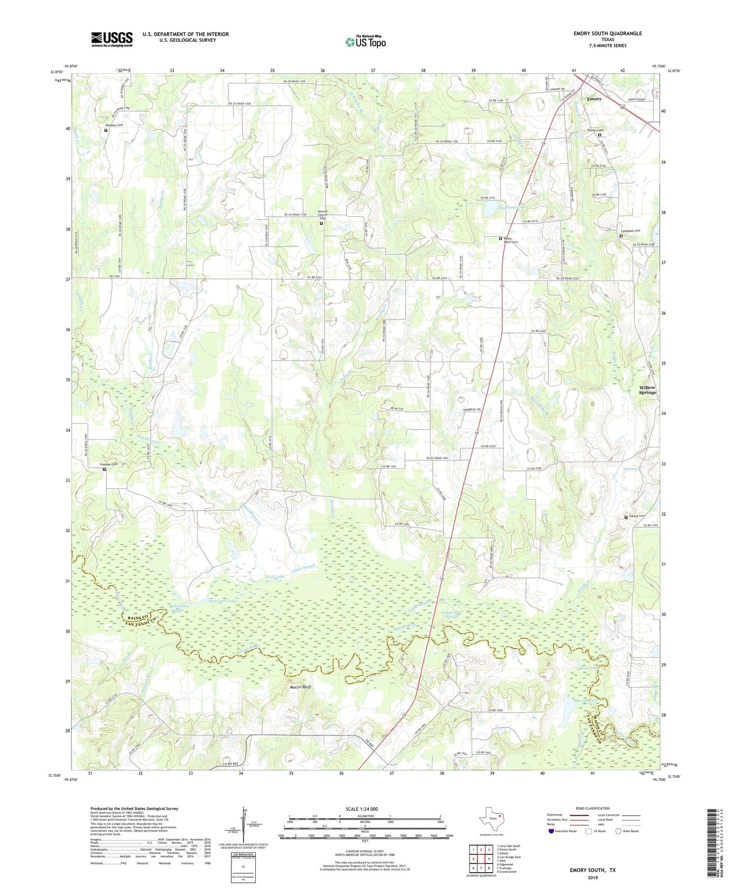
2019 topographic map quadrangle Emory South in the state of Texas. Scale: 1:24000. Based on the newly updated USGS 7.5' US Topo map series, this map is in the following counties: Rains, Van Zandt. The map contains contour data, water features, and other items you are used to seeing on USGS maps, but also has updated roads and other features. This is the next generation of topographic maps. Printed on high-quality waterproof paper with UV fade-resistant inks.
Quads adjacent to this one:
West: Iron Bridge Dam
Northwest: Lone Oak South
North: Emory North
Northeast: Arbala
East: Alba
Southeast: Grand Saline
South: Fruitvale
Southwest: Edgewood
Contains the following named places: A C McMilllan African American Museum, Allread Creek, Bear Creek, Bee Branch, Brushy Creek, Campbell Cemetery, Clewis Cemetery, Danley Cemetery, Ditch Lake, Dunbar, Dunbar Union Church, Emory, Fish Lake, Glade Creek, Henderson County Clint W Murchison Memorial Library, Highland Lake, Holcomb Lake, Holcomb Slough, Lake Church, Little Slough, Long Branch, Martin Bluff, Mill Creek, Muscadine Branch, Ocean Lake, Rains County, Reeder Creek, Rockey Point Center, Rocky Point Cemetery, Rocky Point Center, Sandy Creek, Shuffle Creek, Smyrna, Smyrna Church Cemetery, Spring Branch, Stewart Branch, Trumble Cemetery, West Brushy Branch, Willow Springs, Woodbury Creek, Woosley Cemetery, Yellow Steer Slough