MyTopo
Emory North Texas US Topo Map
Couldn't load pickup availability
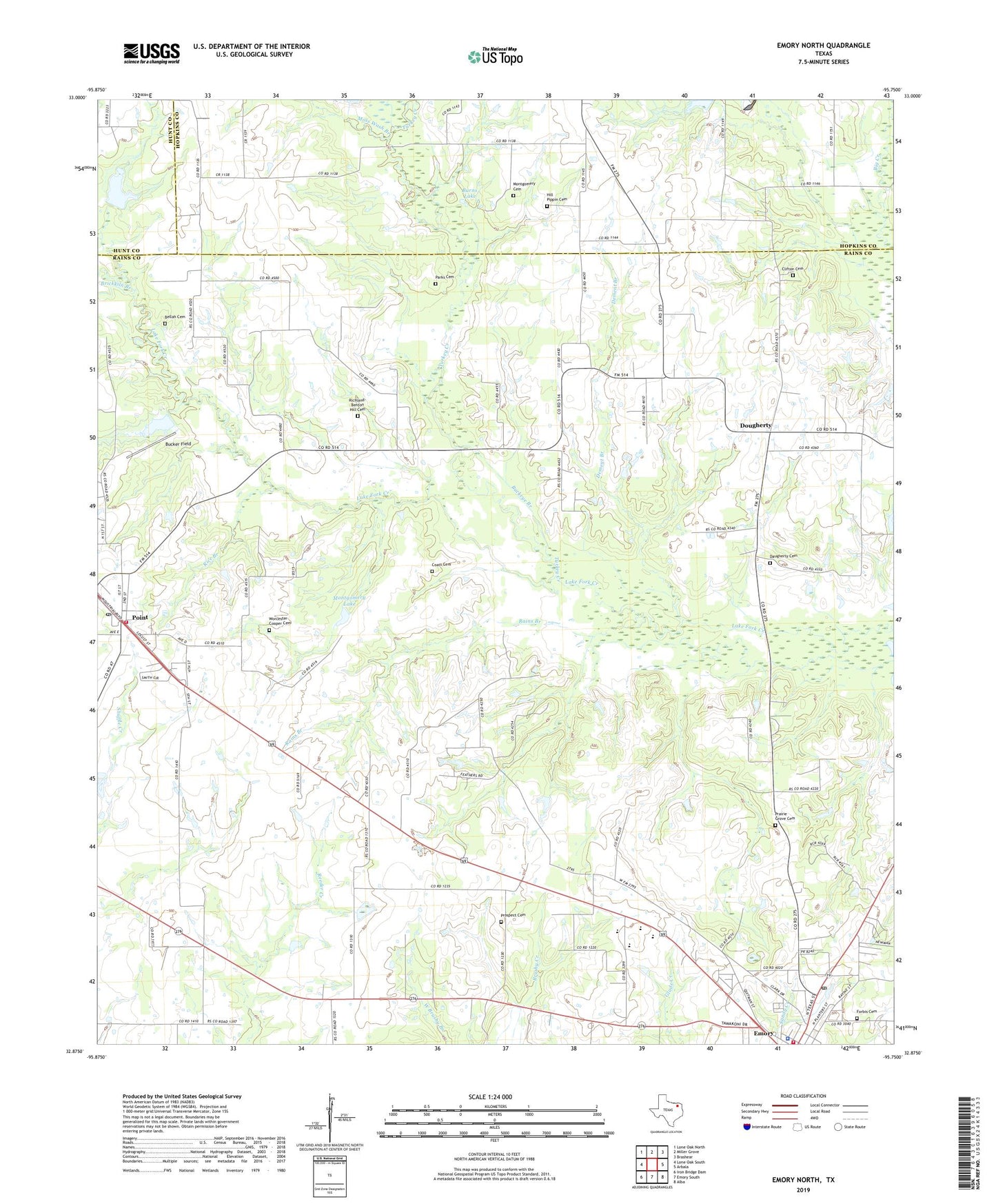
2022 topographic map quadrangle Emory North in the state of Texas. Scale: 1:24000. Based on the newly updated USGS 7.5' US Topo map series, this map is in the following counties: Rains, Hopkins, Hunt. The map contains contour data, water features, and other items you are used to seeing on USGS maps, but also has updated roads and other features. This is the next generation of topographic maps. Printed on high-quality waterproof paper with UV fade-resistant inks.
Quads adjacent to this one:
West: Lone Oak South
Northwest: Lone Oak North
North: Miller Grove
Northeast: Brashear
East: Arbala
Southeast: Alba
South: Emory South
Southwest: Iron Bridge Dam
This map covers the same area as the classic USGS quad with code o32095h7.
Contains the following named places: Bellah Cemetery, Brickkiln Branch, Bucker Field, Buckeye Branch, Burns Lake, Church of the Living God, City of Emory, City of Point, Clifton Cemetery, Coats Cemetery, County Line, County Line Church, Dam Nine, Dam Twentytwo, Daugherty Baptist Church, Daugherty Cemetery, Dement Branch, Dougherty, Emory City Hall, Emory Post Office, Emory Volunteer Fire Department, Forbis Cemetery, Hill Pippin Cemetery, Mitcham Branch, Montgomery Cemetery, Montgomery Lake, Montgomery Lake Dam, Moss Wash Branch, Parks Family Cemetery, Point, Point City Hall, Point Post Office, Point Volunteer Fire Department, Prairie Grove Cemetery, Prairie Grove Church, Prospect, Prospect Cemetery, Prospect Church, Rains Branch, Rains County Constable's Office, Rains County Sheriff's Office, Rains High School, Rice Branch, Richland, Richland Baptist Church, Richland-Benton Hill Cemetery, Sand Flat Community Center, Slough Creek, Soil Conservation Service Site 22 Dam, Soil Conservation Service Site 22 Reservoir, Soil Conservation Service Site 7 Dam, Soil Conservation Service Site 7 Reservoir, Soil Conservation Service Site 9 Dam, Soil Conservation Service Site 9 Reservoir, T Dam 7, Turkey Creek, Worcester-Cooper Cemetery, ZIP Code: 75472