MyTopo
Ezzell Texas US Topo Map
Couldn't load pickup availability
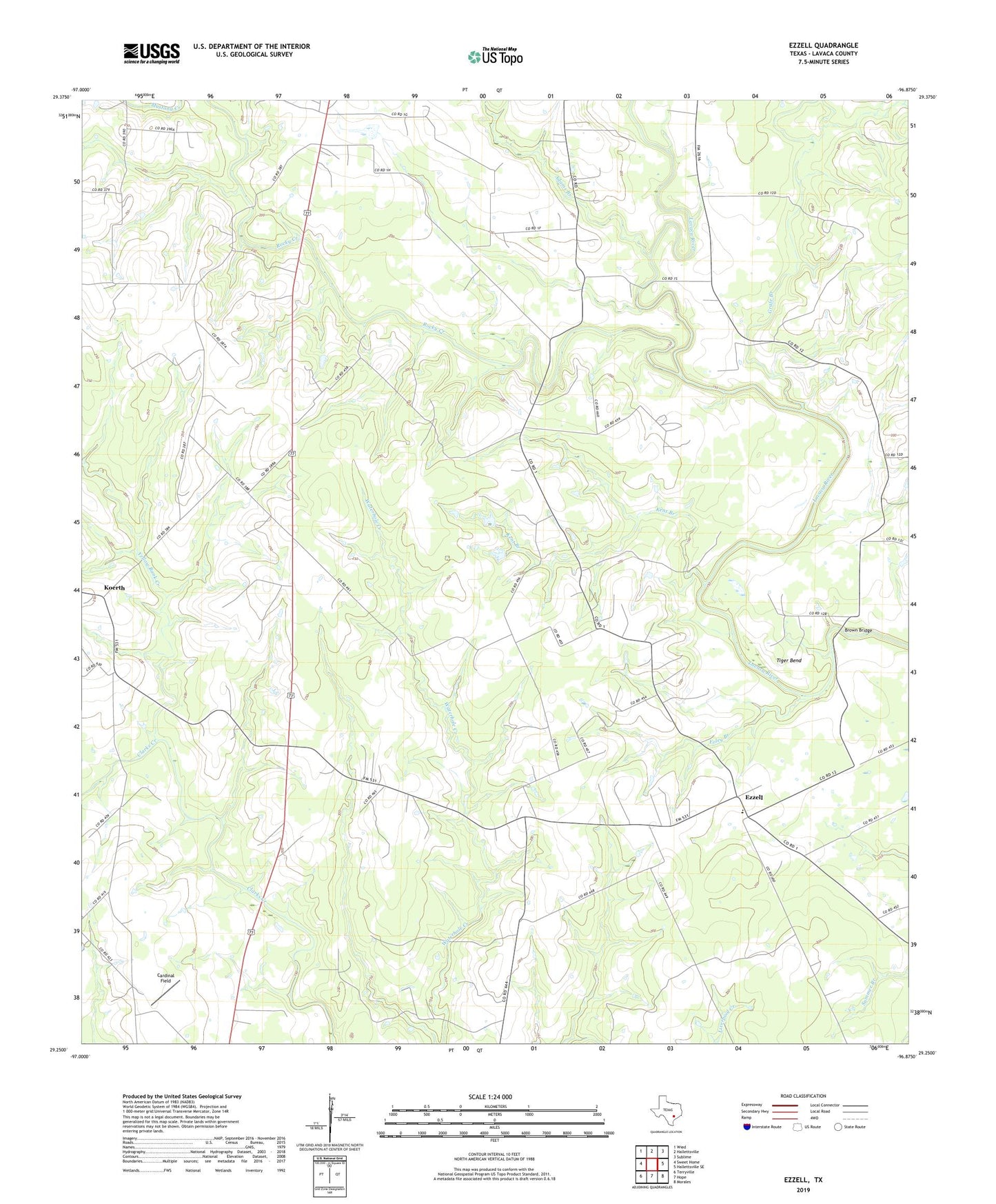
2019 topographic map quadrangle Ezzell in the state of Texas. Scale: 1:24000. Based on the newly updated USGS 7.5' US Topo map series, this map is in the following counties: Lavaca. The map contains contour data, water features, and other items you are used to seeing on USGS maps, but also has updated roads and other features. This is the next generation of topographic maps. Printed on high-quality waterproof paper with UV fade-resistant inks.
Quads adjacent to this one:
West: Sweet Home
Northwest: Wied
North: Hallettsville
Northeast: Sublime
East: Hallettsville SE
Southeast: Morales
South: Hope
Southwest: Terryville
Contains the following named places: Adams Branch, Brown Bridge, Cardinal Field, Ezzell, Foley Branch, Grafe Branch, Kent Branch, Koerth, Mossy Grove Church, Providence School, Rocky Creek, Salem Church, Tiger Bend, Yellow Bank Creek, Yoakum Division