MyTopo
Fannett West Texas US Topo Map
Couldn't load pickup availability
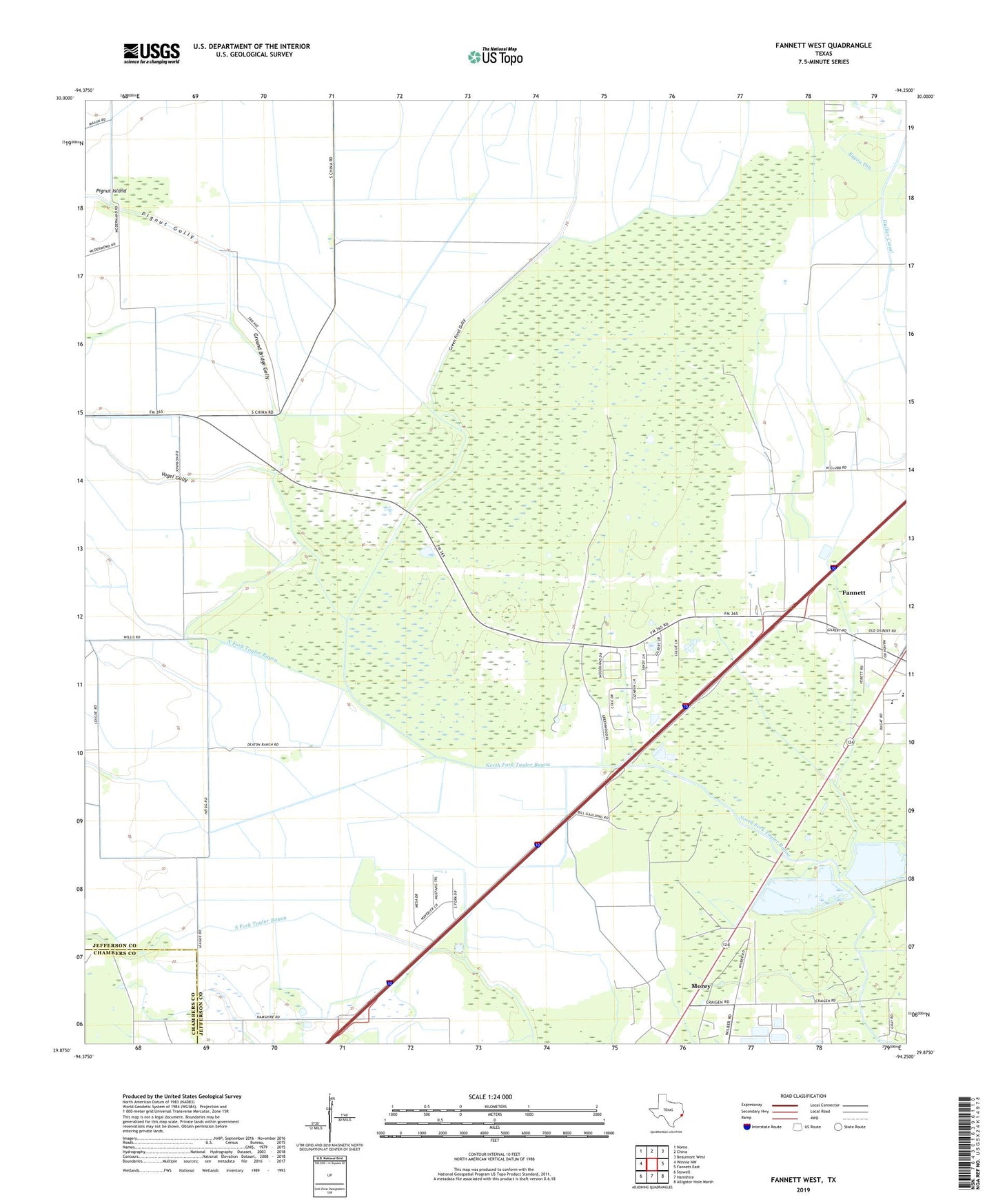
2019 topographic map quadrangle Fannett West in the state of Texas. Scale: 1:24000. Based on the newly updated USGS 7.5' US Topo map series, this map is in the following counties: Jefferson, Chambers. The map contains contour data, water features, and other items you are used to seeing on USGS maps, but also has updated roads and other features. This is the next generation of topographic maps. Printed on high-quality waterproof paper with UV fade-resistant inks.
Quads adjacent to this one:
West: Winnie NW
Northwest: Nome
North: China
Northeast: Beaumont West
East: Fannett East
Southeast: Alligator Hole Marsh
South: Hamshire
Southwest: Stowell
Contains the following named places: Broussard Farm Airport, Fannett, First Baptist Church of Fannett, Gilbert Ranch Oil Field, Gilbert Woods, Green Pond Gully, Ground Bridge Gully, Jefferson County Constable's Office Precinct 4, Marrs Mclean Gas Field, Morey, Pignut Gully, Pignut Island, Vogel Gully