
MyTopo
Fannin Texas US Topo Map
Couldn't load pickup availability
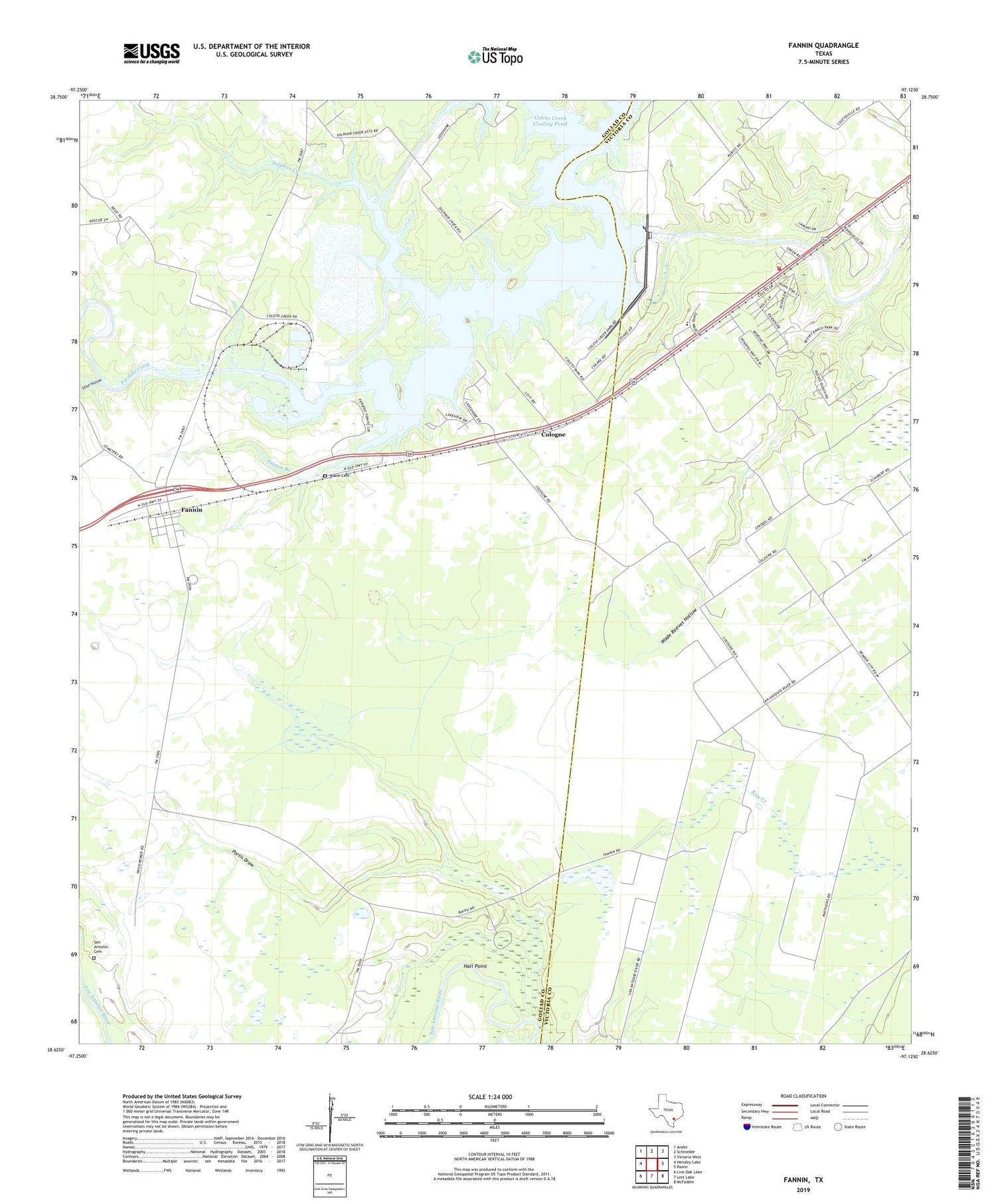
2019 topographic map quadrangle Fannin in the state of Texas. Scale: 1:24000. Based on the newly updated USGS 7.5' US Topo map series, this map is in the following counties: Goliad, Victoria. The map contains contour data, water features, and other items you are used to seeing on USGS maps, but also has updated roads and other features. This is the next generation of topographic maps. Printed on high-quality waterproof paper with UV fade-resistant inks.
Quads adjacent to this one:
West: Hensley Lake
Northwest: Ander
North: Schroeder
Northeast: Victoria West
East: Raisin
Southeast: McFaddin
South: Lott Lake
Southwest: Live Oak Lake
Contains the following named places: Battle Oil Field, Coleto Creek Cooling Pond, Coleto Creek Dam, Coleto Creek Regional Park, Cologne, Cologne West Oil Field, Fannin, Fannin East Oil Field, Fannin Post Office, Fannin State Park, Hall Point, Mallahau Church, Noble Cemetery, Oak Village, Onderdunk Lake, Payton Branch, Perdido Creek, Portis Draw, Raisin Volunteer Fire Department Station 1, Road Creek, San Antonio Cemetery, Sand Hollow, Sulphur Creek, Swickheimer Ranch, Terrell Point Oil Field, Turkey Creek, Wade Reeves Hollow, ZIP Code: 77960


