MyTopo
McFaddin Texas US Topo Map
Couldn't load pickup availability
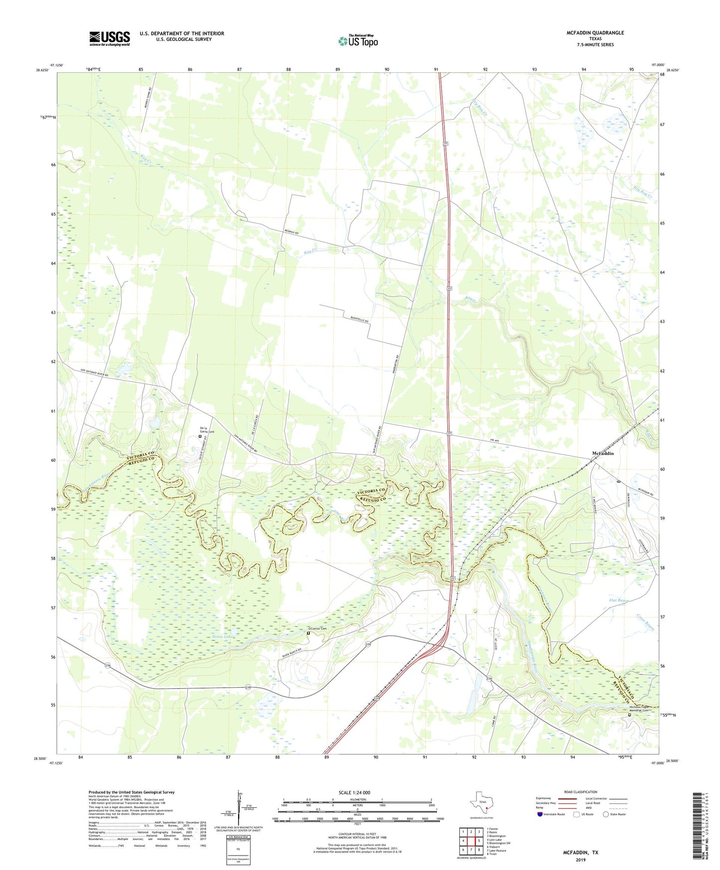
2022 topographic map quadrangle McFaddin in the state of Texas. Scale: 1:24000. Based on the newly updated USGS 7.5' US Topo map series, this map is in the following counties: Victoria, Refugio. The map contains contour data, water features, and other items you are used to seeing on USGS maps, but also has updated roads and other features. This is the next generation of topographic maps. Printed on high-quality waterproof paper with UV fade-resistant inks.
Quads adjacent to this one:
West: Lott Lake
Northwest: Fannin
North: Raisin
Northeast: Bloomington
East: Bloomington SW
Southeast: Tivoli
South: Lake Pasture
Southwest: Vidaurri
This map covers the same area as the classic USGS quad with code o28097e1.
Contains the following named places: Anaqua Oil Field, De la Garza Cemetery, Flat Bayou, Hines Lake, Huff Oil Field, Inari, McFaddin, McFaddin Oil Field, McFaddin Post Office, Mount Salem Church, Nicholas Fagan Memorial Cemetery, O'Connor Cemetery, Old River, Saint Dennis Church