MyTopo
Five Wells Ranch SE Texas US Topo Map
Couldn't load pickup availability
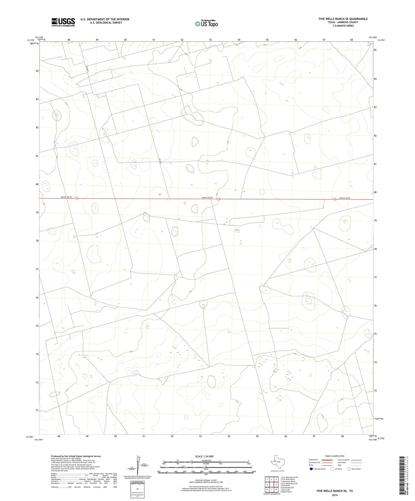
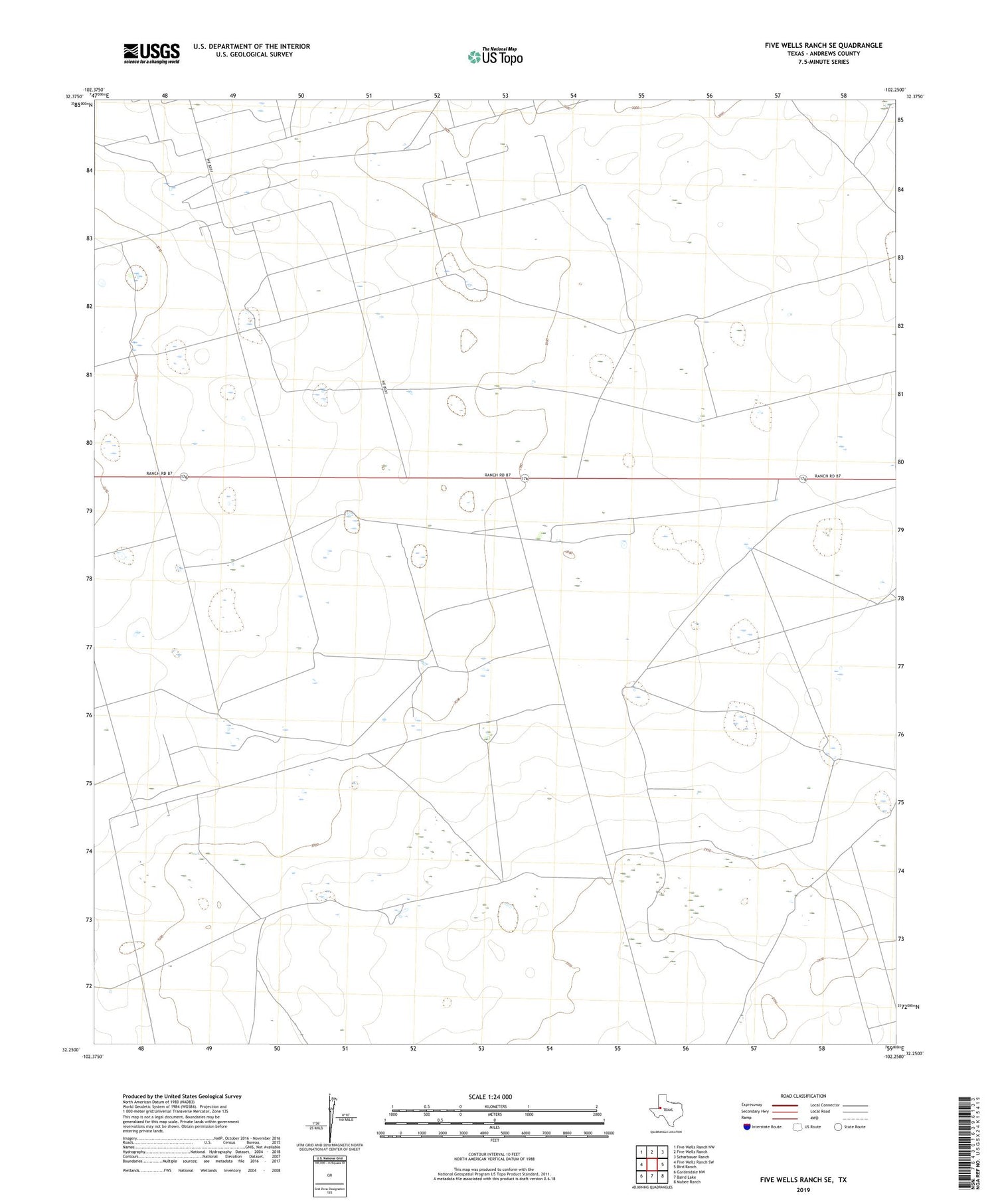
2019 topographic map quadrangle Five Wells Ranch SE in the state of Texas. Scale: 1:24000. Based on the newly updated USGS 7.5' US Topo map series, this map is in the following counties: Andrews. The map contains contour data, water features, and other items you are used to seeing on USGS maps, but also has updated roads and other features. This is the next generation of topographic maps. Printed on high-quality waterproof paper with UV fade-resistant inks.
Quads adjacent to this one:
West: Five Wells Ranch SW
Northwest: Five Wells Ranch NW
North: Five Wells Ranch
Northeast: Scharbauer Ranch
East: Bird Ranch
Southeast: Mabee Ranch
South: Baird Lake
Southwest: Gardendale NW
Contains the following named places: Buffalo Windmill, Bullwell Windmill, Doodlebug Windmill, Lake Windmill, Magutex Oil Field, New Windmill, Oil Well Windmill, Okie Windmill, Prairie Dog Flat Windmill, Sixteen Corner Windmill, South Windmill, Trap Windmill, Triangle Windmill, Two Section Windmill, West Windmill, Windmill Number Fiftynine, Windmill Number Nineteen, Windmill Number Seventeen, Windmill Number Sixtyfive, Windmill Number Thirtyfive, Windmill Number Thirtyfour, Windmill Number Twenty