MyTopo
Five Wells Ranch Texas US Topo Map
Couldn't load pickup availability
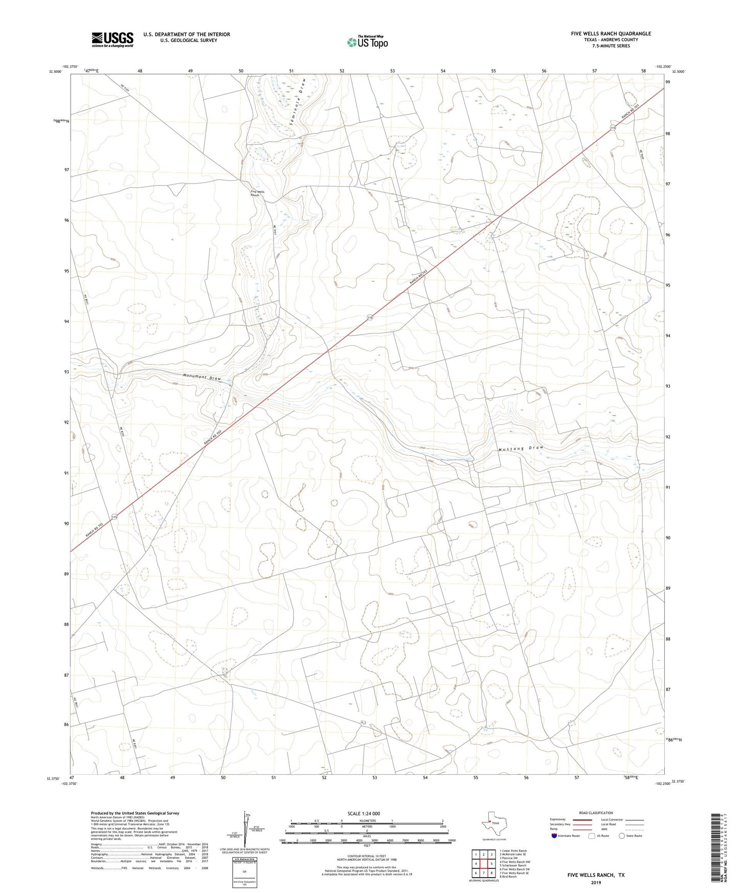
2022 topographic map quadrangle Five Wells Ranch in the state of Texas. Scale: 1:24000. Based on the newly updated USGS 7.5' US Topo map series, this map is in the following counties: Andrews. The map contains contour data, water features, and other items you are used to seeing on USGS maps, but also has updated roads and other features. This is the next generation of topographic maps. Printed on high-quality waterproof paper with UV fade-resistant inks.
Quads adjacent to this one:
West: Five Wells Ranch NW
Northwest: Cedar Point Ranch
North: McKenzie Lake SE
Northeast: Patricia SW
East: Scharbauer Ranch
Southeast: Bird Ranch
South: Five Wells Ranch SE
Southwest: Five Wells Ranch SW
This map covers the same area as the classic USGS quad with code o32102d3.
Contains the following named places: Bull Skeen Windmill, Five Wells Ranch, Goldsmith Windmill, Hog Eye Windmill, Horseshoe Windmill, House Windmill, Hutex North Oil Field, Hutex Oil Field, Kildee Windmill, Middle Windmill, Miller Windmill, Monument Draw, R B Windmill, Seminole Draw, South Kildee Windmill, Texaco Windmill, Windmill Number Fifteen, Windmill Number Five, Windmill Number Fourteen, Windmill Number Seventeen, Windmill Number Sixteen, Windmill Number Thirtyfour