MyTopo
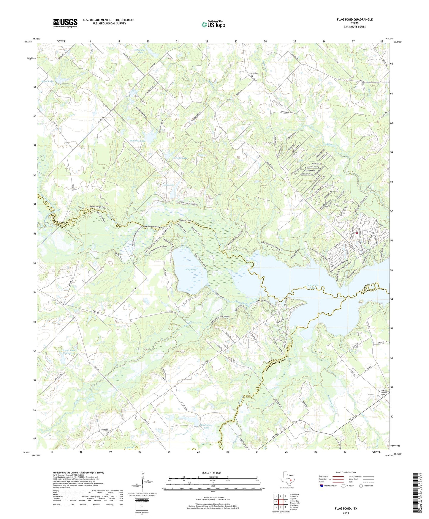
Flag Pond Texas US Topo Map
Couldn't load pickup availability
2019 topographic map quadrangle Flag Pond in the state of Texas. Scale: 1:24000. Based on the newly updated USGS 7.5' US Topo map series, this map is in the following counties: Burleson, Lee, Washington. The map contains contour data, water features, and other items you are used to seeing on USGS maps, but also has updated roads and other features. This is the next generation of topographic maps. Printed on high-quality waterproof paper with UV fade-resistant inks.
Quads adjacent to this one:
West: Dime Box
Northwest: Deanville
North: Frenstat
Northeast: Lyons
East: Somerville
Southeast: Burton
South: Carmine
Southwest: Ledbetter
Contains the following named places: Alum Creek, Birch Cemetery, Birch Creek Area Volunteer Fire Department, Birch Creek State Park, Bredthauer Lake, Bredthauer Lake Dam, Cedar Creek, East Yegua Creek, Edwards Lake, Edwards Lake Dam, Flag Pond, Flat Prairie Cemetery, Flat Prairie Church, Fourmile Creek, Gerdes Lake Number 2, Gerdes Lake Number 2 Dam, Gerland Lake, Gerland Lake Dam, Hickory Creek, Kerr Creek, Lake Somerville State Park, Lake Somerville Trailway, Lamb Lake, Lamb Lake Dam, McCain Creek, McCain Creek Park, Middle Yegua Creek, Nails Creek, Nails Creek State Park, Newman Lake Dam, Post Oak School, Saint Mary Church, Schindler Lake Dam, Schlindler Lake, Ward Lake, Ward Lake Dam