MyTopo
Frenstat Texas US Topo Map
Couldn't load pickup availability
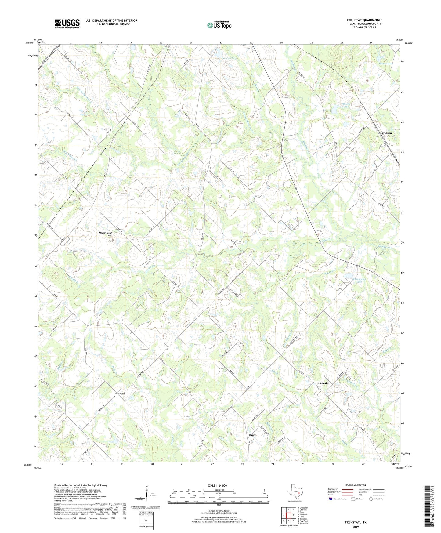
2022 topographic map quadrangle Frenstat in the state of Texas. Scale: 1:24000. Based on the newly updated USGS 7.5' US Topo map series, this map is in the following counties: Burleson. The map contains contour data, water features, and other items you are used to seeing on USGS maps, but also has updated roads and other features. This is the next generation of topographic maps. Printed on high-quality waterproof paper with UV fade-resistant inks.
Quads adjacent to this one:
West: Deanville
Northwest: Chriesman
North: Caldwell
Northeast: Tunis
East: Lyons
Southeast: Somerville
South: Flag Pond
Southwest: Dime Box
This map covers the same area as the classic USGS quad with code o30096d6.
Contains the following named places: Beaird Cemetery, Birch, Brushy Creek, Davidson, Dry Hollow Creek, Elm Branch, Frenstat, Glover Lake, Glover Lake Dam, Harmony, Matcek Lake, Matcek Lake Dam, Mockingbird Hill, Pin Oak Creek, Sanders Lake, Sanders Lake Dam, Schumacher Lake, Schumacher Lake Dam, Second Davidson Creek