MyTopo
Ledbetter Texas US Topo Map
Couldn't load pickup availability
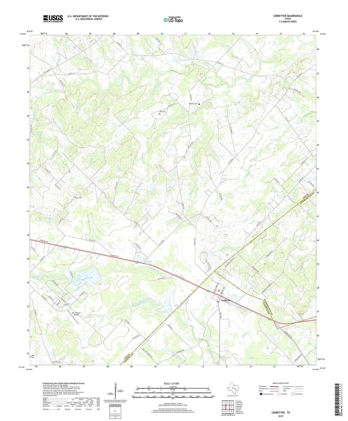
2022 topographic map quadrangle Ledbetter in the state of Texas. Scale: 1:24000. Based on the newly updated USGS 7.5' US Topo map series, this map is in the following counties: Lee, Fayette, Washington. The map contains contour data, water features, and other items you are used to seeing on USGS maps, but also has updated roads and other features. This is the next generation of topographic maps. Printed on high-quality waterproof paper with UV fade-resistant inks.
Quads adjacent to this one:
West: Giddings
Northwest: Lincoln
North: Dime Box
Northeast: Flag Pond
East: Carmine
Southeast: Round Top
South: Nechanitz
Southwest: Warda
This map covers the same area as the classic USGS quad with code o30096b7.
Contains the following named places: Atkinson Cemetery, Bar S Ranch Airport, Dam Number 1, Dam Number 2, Flat Rock Creek, Globe Hill Church, Goerlitz Lake, Goerlitz Lake Dam, Hickory Creek, Jones Colony Church, KOKE-FM (Giddings), Ledbetter, Ledbetter Post Office, Ledbetter Volunteer Fire Department, Line Branch, Persimmon Branch, Persimmons Branch, Pin Oak Creek, Rost Cemetery, Soil Conservation Service Site 1 Dam, Soil Conservation Service Site 1 Reservoir, Soil Conservation Service Site 2 Dam, Soil Conservation Service Site 2 Reservoir, Stueber Branch, Sunnyside Church, Vernon Lake, Water Hole Branch, West Fork Cummins Creek, Wolf Branch, Wolf Cemetery, ZIP Code: 78946