MyTopo
Fort Bliss NE Texas US Topo Map
Couldn't load pickup availability
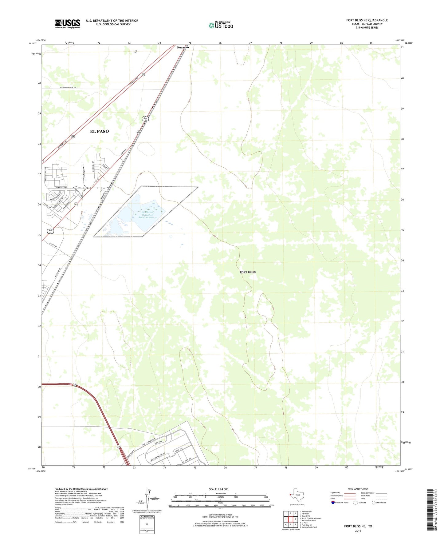
2019 topographic map quadrangle Fort Bliss NE in the state of Texas. Scale: 1:24000. Based on the newly updated USGS 7.5' US Topo map series, this map is in the following counties: El Paso. The map contains contour data, water features, and other items you are used to seeing on USGS maps, but also has updated roads and other features. This is the next generation of topographic maps. Printed on high-quality waterproof paper with UV fade-resistant inks.
Quads adjacent to this one:
West: North Franklin Mountain
Northwest: Newman SW
North: Newman
Northeast: Desert SW
East: Nations East Well
Southeast: Nations South Well
South: Fort Bliss SE
Southwest: El Paso
Contains the following named places: El Paso North Central Division, KHEY-AM (El Paso), Newman, Newman Radio Beacon, Northeast Oxidation Pond Number 1, Northeast Oxidation Pond Number 1 Dam, Northeast Oxidation Pond Number 2, Northeast Oxidation Pond Number 2 Dam, Northeast Oxidation Pond Number 3, Northeast Oxidation Pond Number 3 Dam, Northeast Oxidation Pond Number 4, Northeast Oxidation Pond Number 4 Dam