
MyTopo
Fort Hood Texas US Topo Map
Couldn't load pickup availability
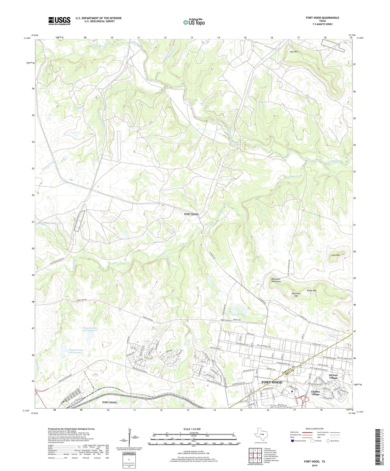
2019 topographic map quadrangle Fort Hood in the state of Texas. Scale: 1:24000. Based on the newly updated USGS 7.5' US Topo map series, this map is in the following counties: Coryell, Bell. The map contains contour data, water features, and other items you are used to seeing on USGS maps, but also has updated roads and other features. This is the next generation of topographic maps. Printed on high-quality waterproof paper with UV fade-resistant inks.
Quads adjacent to this one:
West: Twin Mountains
Northwest: Pidcoke
North: Shell Mountains
Northeast: North Fort Hood
East: Post Oak Mountain
Southeast: Killeen
South: McMillan Mountains
Southwest: Copperas Cove
Contains the following named places: Abrams Field House, Antelope Crossing, Blackwell Gap, Blackwell Mountains, Bushy Gap, Carl R Darnall Army Medical Center, Chaffee Village, Clarke Elementary School, Clear Creek, Comanche Village I, Comanche Village II, Comanche Village III, Copperas Cove Dam Number 1, Copperas Cove Dam Number 2, Copperas Cove Dam Number 3, Copperas Cove Lake Number 2, Copperas Cove Lake Number 3, Cottonwood Creek, Duncan Elementary School, First Calvary Division Museum, Fort Hood Census Designated Place, Fort Hood Division, Fort Hood Post Office, Hargrove Creek, House Creek, House Crossing, Howze Theater, Jack Mountain, Jackson Crossing, Lake Henry, Lake Henry Dam, Liese Field, Lone Mountain, McNair Village, Middle Crossing, Prichard Athletic Field, Saint Elijah Village, Smith Middle School, Soldier Development Center, Soldier Readiness Processing Center, Stampede Creek, Table Rock Creek, Turkey Run, ZIP Code: 76544


