MyTopo
North Fort Hood Texas US Topo Map
Couldn't load pickup availability
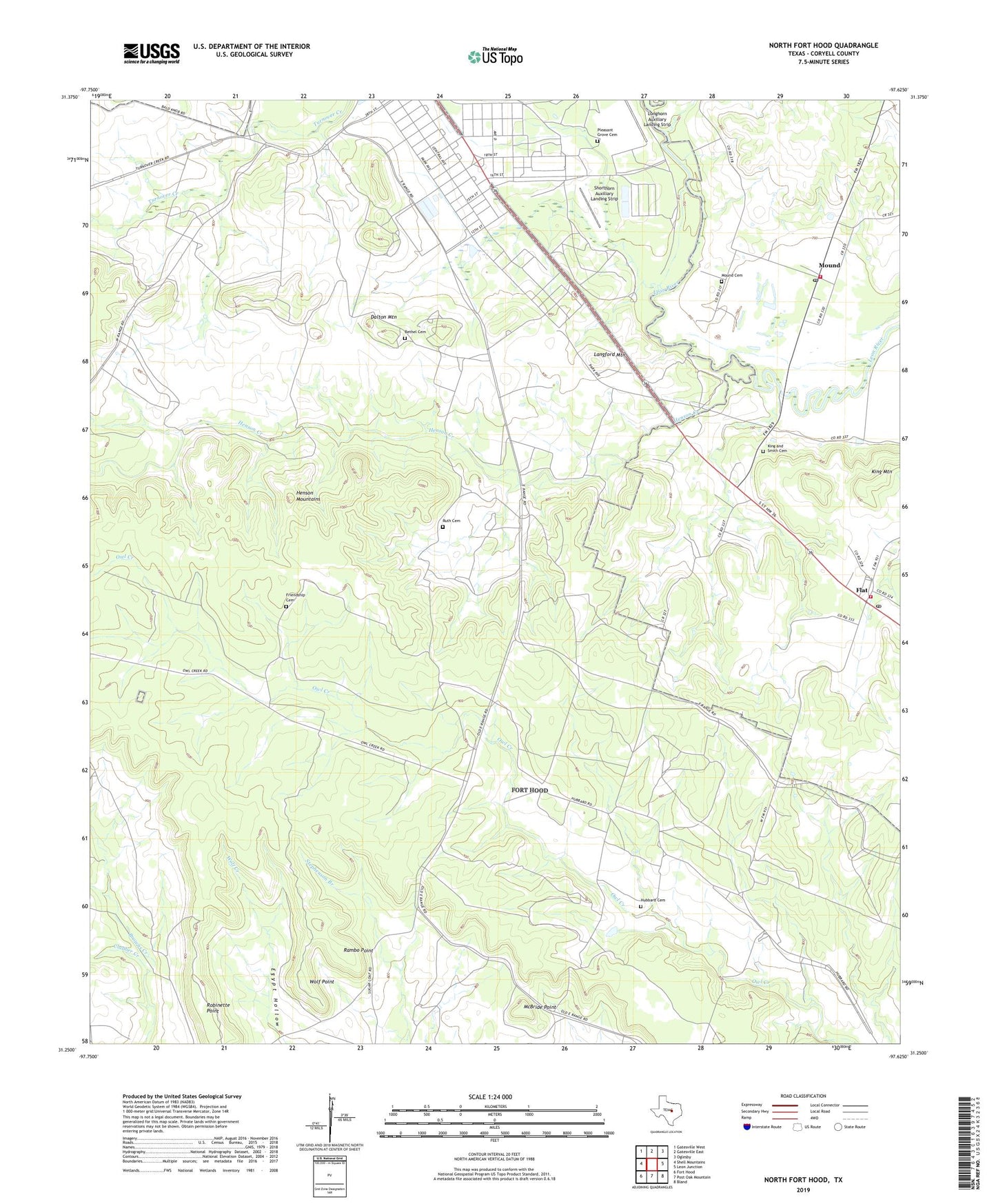
2022 topographic map quadrangle North Fort Hood in the state of Texas. Scale: 1:24000. Based on the newly updated USGS 7.5' US Topo map series, this map is in the following counties: Coryell. The map contains contour data, water features, and other items you are used to seeing on USGS maps, but also has updated roads and other features. This is the next generation of topographic maps. Printed on high-quality waterproof paper with UV fade-resistant inks.
Quads adjacent to this one:
West: Shell Mountains
Northwest: Gatesville West
North: Gatesville East
Northeast: Oglesby
East: Leon Junction
Southeast: Bland
South: Post Oak Mountain
Southwest: Fort Hood
This map covers the same area as the classic USGS quad with code o31097c6.
Contains the following named places: Bethel Cemetery, Clabber Creek, Dalton Mountain, Flat, Flat Post Office, Flat Volunteer Fire Department and First Responders, Fort Hood, Friendship Cemetery, Henson Creek, Henson Mountains, Hubbard Cemetery, King and Smith Cemetery, King Mountain, Langford Mountain, Longhorn Auxiliary Landing Strip, McBride Point, Mound, Mound Cemetery, Mound Census Designated Place, Mound Post Office, Mound Volunteer Fire Department and First Responders, Pleasant Grove Cemetery, Rambo Point, Robinette Point, Ruth Cemetery, Shorthorn Auxiliary Landing Strip, White Mound Church, Wolf Point