
MyTopo
Frost Texas US Topo Map
Couldn't load pickup availability
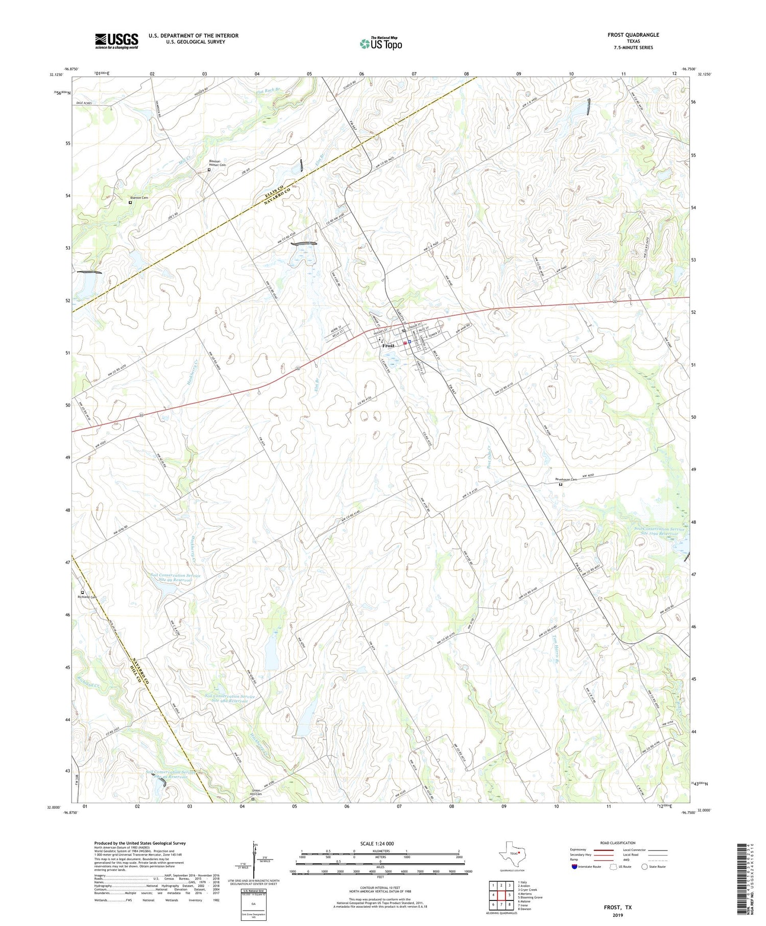
2019 topographic map quadrangle Frost in the state of Texas. Scale: 1:24000. Based on the newly updated USGS 7.5' US Topo map series, this map is in the following counties: Navarro, Ellis, Hill. The map contains contour data, water features, and other items you are used to seeing on USGS maps, but also has updated roads and other features. This is the next generation of topographic maps. Printed on high-quality waterproof paper with UV fade-resistant inks.
Quads adjacent to this one:
West: Mertens
Northwest: Italy
North: Avalon
Northeast: Cryer Creek
East: Blooming Grove
Southeast: Dawson
South: Irene
Southwest: Malone
Contains the following named places: Blanton Cemetery, Blanton-Hooser Cemetery, City of Frost, Dam Number 101A, Dam Number 101O, Dam Number 103B, Dam Number 119A, Dam Number 49, Dam Number 99, Frost, Frost City Hall, Frost Police Department, Frost Post Office, Frost Volunteer Fire Department, Joe Parnum Field, Lone Oak, Pevehouse Cemetery, Richland Cemetery, Soil Conservation Service Site 100a Dam, Soil Conservation Service Site 100a Reservoir, Soil Conservation Service Site 101 Dam, Soil Conservation Service Site 101 Reservoir, Soil Conservation Service Site 101a Dam, Soil Conservation Service Site 101a Reservoir, Soil Conservation Service Site 101c Dam, Soil Conservation Service Site 101c Reservoir, Soil Conservation Service Site 103b Dam, Soil Conservation Service Site 103b Reservoir, Soil Conservation Service Site 119a Reservoir, Soil Conservation Service Site 49 Dam, Soil Conservation Service Site 49 Reservoir, Soil Conservation Service Site 98a Dam, Soil Conservation Service Site 98a Reservoir, Soil Conservation Service Site 99 Dam, Soil Conservation Service Site 99 Reservoir, Union Hill Cemetery, ZIP Code: 76641


